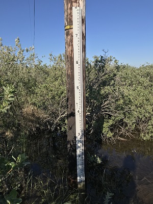
Quinhagak flood staff. This picture was taken during installation on June 18, 2018, when water levels from the Kanektok River were high.
A time-lapse camera, wooden stakes, and flood staff were installed from 2017 to 2018 at Quinhagak to monitor shoreline change in front of the community sewage lagoon and dump sites. Installation was funded by Alaska Institute for Justice and the Alaska Ocean Observing Systems, continued monitoring is being completed by the Native Village of Kwinhagak.
Measurements at Quinhagak have been made in front of the community's sewage lagoon at Transects 1-3.
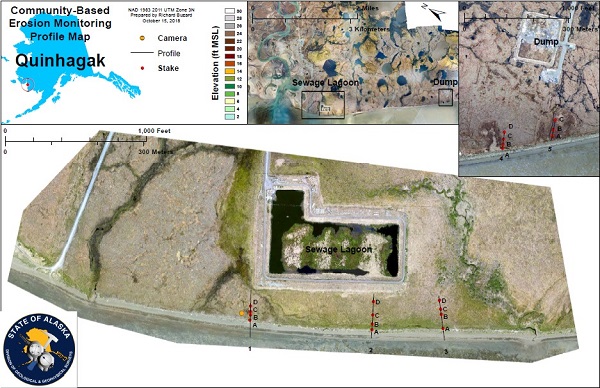
Click for enlarged PDF version of the profile map.

Transect 1

Transect 2

Transect 3


