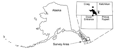
Burns, L.E., Graham, G.R.C., Barefoot, J.D., Geoterrex-Dighem, and WGM Mining and Geological Consultants, Inc., 2020, Ketchikan electromagnetic and magnetic airborne geophysical survey data compilation: Alaska Division of Geological & Geophysical Surveys Geophysical Report 2020-5, 19 p. https://doi.org/10.14509/30430
 Report Information
 Geospatial & Analytical Data
Aeromagnetic; Aeromagnetic Data; Aeromagnetic Map; Aeromagnetic Survey; Aiken Cove; Aiken Creek; Aiken Lake; Airborne Geophysical Survey; Alarm Mine; Analytic Signal; Apparent Resistivity Data; Apparent Resistivity Map; Apparent Resistivity Survey; Babe Islands; Barren Mountain; Beaver Creek; Beaver Mountain; Big Creek; Black Sand Cove; Blank Inlet; Bostwick Creek; Bostwick Inlet; Brennan Bay; Bucareli Bay; Cabin Creek; Cannery Cove; Cave Creek; Chapin Peak; Cholmondeley Sound; City Of Thorne Bay; Clam Cove; Clare Island; Clarence Strait; Clarno Cove; Clump Island; Conductivity Survey; Cordova Bay; Dall Bay; Deichman Island; Dog Salmon Creek; Dolomi Bay; Dora Bay; Dora Lake; Downdraft Lake; Electromagnetic Data; Electromagnetic Survey; Eudora Mountain; Exploration; First Vertical Derivative; Foot Lake; Frequency Domain Electromagnetic Data; Geologic; Geology; Geophysical Map; Geophysical Survey; Geophysics; Geophysics Search Tag; George Inlet; Goose Bay; Goose Creek; Government Creek; Grant Cove; Green Monster Mountain; Gridded Data; Haida Mine; Hassiah Inlet; Helen Island; Hetta Inlet; Hetta Lake; It Mine; John Creek; Kasaan Bay; Kassa Inlet; Kassa Island; Keete Inlet; Keete Island; Ketchikan Mining District; Khayyam Mine; Kina Creek; Kina Lake; Kitkun Bay; Lake Ellen; Lake Gertrude; Lake Isabel; Lake Josephine; Lake Marge; Lake Mary; Lindeman Lake; Line Data; Loon Lake; Mabel Bay; Mabel Island; Magnetic Data; Magnetic Survey; Magnetics; Mckenzie Inlet; Miller Lake; Mills Bay; Moira Sound; Myrtle Creek; Myrtle Lake; Natzuhini Bay; Nehenta Bay; Nelson Cove; Niblack Lake; Nowiskay Cove; Omar Creek; Paul Lake; Paul Young Creek; Peacock Island; Phocena Bay; Polk Creek; Polk Inlet; Poor Man Creek; Port Johnson; Portage Creek; Power Lake; Remote Sensing; Resistivity; Resistivity Survey; Rock Creek; Rock Lake; Salt Chuck Mine; Saltery Cove; Setter Lake; Skowl Arm; Smooth Mountain; Summit Lake; Sunny Cove; Sunny Creek; Tolstoi Bay; Tongass Narrow; Trocadero Bay; Twelvemile Arm; Twelvemile Creek; Unlucky Island; Vallenar Creek; geoscientificInformation


