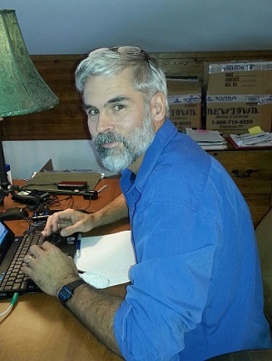
Chief, Geologic Information Center - Mike Hendricks is a Geospatial Analyst & Chief of the Alaska Geologic Information Center which provides information technology, publication, illustration, cartography, and GIS support to the Division, other State and Federal organizations, as well as the general public. In addition, he servers as the Division GIS Coordinator and Geographic Information Systems (GIS) Data Manager and Technical Expert, where he develops geospatial databases, GIS web services, tools, models, maps, and training programs to support the Division's geologic mission. Previous to his position with the DGGS, Mike served on the faculty of the United States Military Academy's Geospatial Information Science Program, at West Point New York, where he taught GIS, designed cartographic products, and conducted applied research in land navigation education using location-based technology.
Education and/or Training
Ph.D. 2004, University of Maine, Spatial Information and Science and Engineering
M.S. 1994, University of South Carolina, Geography - Geographic Information Systems
B.S. 1986, University of Delaware, Civil Engineering
Projects and/or Research Interests
Professional Experience
2021-present, Geospatial Analyst & Chief of the Geologic Information Center, State of Alaska, Division of Geological & Geophysical Surveys, Fairbanks, AK
2014-present, Geospatial Analyst, State of Alaska, Division of Geological & Geophysical Surveys, Fairbanks, AK
2004-2014, Associate and Assistant Professor of Geospatial Information Science, United States Military Academy, West Point, NY
2000-2001, Executive Officer, 29th Topographic Engineering Battalion, Fort Shafter, HI
1999-2000, Geospatial Intelligence Officer, U.S. Army Pacific (USARPAC), Fort Shafter, HI
1995-1998, Assistant Professor and Instructor of Geospatial Information Science, United States Military Academy, West Point, NY
Selected Professional Activities
Academic Achievement Award, United States Geospatial Intelligence Foundation (USGIF), 2011
Selected Publications
- Macpherson, A.E., Hendricks, M.D., and Athey, J.E., 2024, AK GeMS Symbology: A description of the AK GeMS Style File: Alaska Division of Geological & Geophysical Surveys Miscellaneous Publication 169 v. 2, 6 p. https://doi.org/10.14509/31101
- Hendricks, M.D., Ekberg, P.G., Athey, J.E., Wyatt, W.C., Willingham, A.L., and Naibert, T.J., 2021, AK GeMS data dictionary: A description of the Alaska geologic mapping schema: Alaska Division of Geological & Geophysical Surveys Miscellaneous Publication 170, 10 p. https://doi.org/10.14509/30669
- Overbeck, J.R., Hendricks, M.D., and Kinsman, N.E.M., 2016, Photogrammetric digital surface models and orthoimagery for 26 coastal communities of western Alaska: Alaska Division of Geological & Geophysical Surveys Raw Data File 2016-1, 3 p. https://doi.org/10.14509/29548
- Gould, A.I., Kinsman, N.E.M., and Hendricks, M.D., 2015, Guide to projected shoreline positions in the Alaska shoreline change tool, in DGGS Staff, Alaska Shoreline Change Tool: Alaska Division of Geological & Geophysical Surveys Miscellaneous Publication 158, 11 p. https://doi.org/10.14509/29503
Selected Presentations
- Hendricks, M.D., Athey, J.E., Macpherson, A.E., Rivera, P.G., Wyatt, W.C., Buchanan, Wes, Montayne, Simone, and Steinleitner, A.M., 2023, Designing a standards-based GIS production system in Alaska (presentation): Alaska Geospatial Summit, Anchorage, Alaska, Oct 25-27, 2023: Alaska Division of Geological & Geophysical Surveys, 14 p. https://doi.org/10.14509/31095
- Hendricks, M.D., and Macpherson, A.E., 2023, Developing, maintaining, and publishing documentation standards (presentation): United States Geological Survey Digital Mapping Techniques Workshop Series DMT2023, Anchorage, Alaska, May 20-24, 2023: Alaska Division of Geological & Geophysical Surveys, 6 p.: Alaska Division of Geological & Geophysical Surveys, 6 p. https://doi.org/10.14509/31022
- Hendricks, M.D., Athey, J.E., Macpherson, A.E., Rivera, P.G., Jr., Wyatt, W.C., Wildland, A.D., and Montayne, Simone, 2022, AK geologic mapping system (presentation): GIS Day Celebration 2022, Nov 14-15, 2022: Alaska Division of Geological & Geophysical Surveys, 10 p. https://doi.org/10.14509/30914
- Hendricks, M.D., Macpherson, A.E., and Athey, J.E., 2022, QA/QC of GeMS Data: A case study of the Alaska DGGS geologic mapping system (presentation): Collaborative Database Effort for Geology (CDEFG) virtual monthly meeting, Jan 10, 2022: Alaska Division of Geological & Geophysical Surveys, 33 p. https://doi.org/10.14509/30861
- Hendricks, M.D., Macpherson, A.E., and Rivera, P.G., Jr., 2021, Visualization considerations with GeMS data and maps (presentation): U.S. Geological Survey Digital Mapping Techniques Workshop Series DMT Lite 2021 (A Virtual Event), Dec 6-7, 2021: Alaska Division of Geological & Geophysical Surveys, 10 p. https://doi.org/10.14509/30827
- Hendricks, M.D., Ekberg, P.G., Athey, J.E., and Macpherson, A.E., 2021, Symbolizing a GeMS Geodatabase (presentation): U.S. Geological Survey Digital Mapping Techniques Workshop Series DMT 2021 (A Virtual Event), June 7-10, 2021: Alaska Division of Geological & Geophysical Surveys, 28 p. https://doi.org/10.14509/30826
- Hendricks, M.D., 2020, Customizing the GeMS Toolbox for local requirements (presentation): U.S. Geological Survey Digital Mapping Techniques Workshop Series DMT Lite 2020 (A Virtual Event), Dec 8, 2020: Alaska Division of Geological & Geophysical Surveys, 12 p. https://doi.org/10.14509/30858
- Athey, J.E., Hendricks, M.D., Ekberg, P.G., and Wyatt, W.C., 2020, Alaska-GeMS multi-map database schema changes from the federal GeMS standard (presentation): Digital Mapping Techniques Workshop, videoconferenced from Reston, Virginia, and Champaign, Illinois, June 8-10, 2020: Alaska Division of Geological & Geophysical Surveys, 29 p. https://doi.org/10.14509/30692
- Wyatt, W.C., Hendricks, M.D., Athey, J.E., and Ekberg, P.G., 2020, Lessons from converting Alaska digital geologic maps to the USGS Geologic Map Schema (GeMS) (presentation): U.S. Geological Survey Digital Mapping Techniques Workshop Series DMT2020 (A Virtual Event), June 8-10, 2020: Alaska Division of Geological & Geophysical Surveys, 23 p. https://doi.org/10.14509/30543
- Athey, J.E., Hendricks, M.D., Gallagher, P.E., and Seitz, S.S., 2018, Status of GeMS-compliant enterprise database model and Alaska GeMS maps (presentation): Digital Mapping Techniques Workshop, Lexington, Kentucky, May 20-23: Alaska Division of Geological & Geophysical Surveys, 22 p. https://doi.org/10.14509/30074
- Athey, J.E., Hendricks, M.D., and Gallagher, P.E., 2017, Building an enterprise version of GeMS (formerly NCGMP09 map schema; presentation): Digital Mapping Techniques Workshop, Minneapolis, Minnesota, May 21-24: Alaska Division of Geological & Geophysical Surveys, 22 p. https://doi.org/10.14509/29732
- Athey, J.E., and Hendricks, M.D., 2016, Agency-wide Implications for Alaska DGGS building a Statewide Geologic 1:100,000 Compilation from an NCGMP09 Multi-map Database (presentation): Digital Mapping Techniques Workshop, Tallahassee, Florida, May 22-25: Alaska Division of Geological & Geophysical Surveys, 21 p. https://doi.org/10.14509/29669
