A geologic map, in the traditional sense, portrays a 2-D representation of earth materials on the ground surface. Traditional geologic maps group together and show types of materials, such as sedimentary and bedrock units, faults, water, glaciers, elevation, and other relevant features.
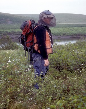
Geologist conducting fieldwork in the Umiat area of Alaska's North Slope. Photo credit: Rocky Reifenstuhl, DGGS, taken 2002.
Geologists produce maps by studying remote-sensing image data from geophysical surveys and satellites, making observations and collecting samples for analysis, and making predictions about what is happening in the subsurface through the interpretation of available information. DGGS generally maps at scales of 1:63,360 (where one inch on the map equals one mile on the ground), while the U.S. Geological Survey has historically produced Alaska geologic maps at a scale of 1:250,000.
Alaska is a jigsaw puzzle of related rock packages, or terranes, placed together over time through the movement and creation of earth materials along faults as tectonic plates drift away from, or run into, each other. Much of Alaska's bedrock is now metamorphic rock that has been deformed under heat and pressure as it was buried under the Earth's surface. Most of Alaska's oldest rocks are approximately one billion years old, although Alaska's oldest known rock is about two billion years old. New earth materials are born from volcanoes, such as along the Aleutian Arc, recycled into sediments from weathering processes, and lithified from sediments into new rock.
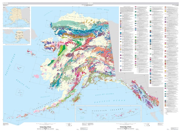
The older metamorphic rocks of Alaska may be broadly simplified into three categories, separated spatially by faults. Many of the faults are recently active:
(1) Metamorphosed continental margin rocks (mostly marine sedimentary rocks) adjacent to the ancestral North American plate and related rocks are found in Alaska's Interior, between the Tintina and Denali fault systems.
(2) Metamorphosed marine and marginal sedimentary rocks, carbonate platform, oceanic igneous (ocean crust) rocks, and volcanic rocks comprise western and northern Alaska, north of the Tintina fault system. These rocks came together during uplift and deformation resulting from the opening of the Canadian Basin (which became the Arctic Ocean), beginning about 150 million years ago.
(3) The variably metamorphosed arc-related volcanic, oceanic, sedimentary, and plutonic rocks of south-central and southeast Alaska have slipped up along the Denali and more southerly fault systems from the southeast over the last 120 million years.
During Alaska's dynamic past, Alaska was enriched in significant resources of minerals and oil and gas. Each group of related rocks has a unique and complicated history, which ensures DGGS geologists conducting research in Alaska or exploring for resources are intrigued and hard at work unraveling their origins.
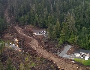
2015 Sitka, Alaska, landslide. Photo credit: Gabriel Wolken, DGGS.
Alaska continues to have a dynamic environment. Because of the subduction of the Pacific tectonic plate and subsequent melting of earth materials beneath the state, earthquakes, volcanoes, mountain building, and other deformation events affect a wide area. In addition, Alaska's arctic landscape, thousands of miles of coast line, and changing climate is creating unstable and hazardous conditions for its infrastructure, cities, and population with an increase in landslide and flooding events and melting sea, glacial, and ground ice. DGGS scientists study current geologic processes and the geologic history of the state to better understand hazardous events and prepare the public for these eventualities.


