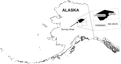
Emond, A.M., MPX Geophysics LTD, Baigent, Mark, Fusso, L.A., and Petersen, E.I., 2025, White Mountains airborne magnetic and radiometric geophysical survey: Alaska Division of Geological & Geophysical Surveys Geophysical Report 2021-3 v. 2, 4 p. https://doi.org/10.14509/31693
 Report Information
 Geospatial & Analytical Data
| White Mountains airborne magnetic and radiometric geophysical survey | Data File Format | File Size | Info |
|---|---|---|---|
| Download gpr2021-3v2_whtmts_2021_ascii_data | ASCII tabular files | 1.4 G | Metadata - Read me |
| Download gpr2021-3v2_whtmts_2021_databases_geosoft | Linedata Geosoft format database | 1.3 G | Metadata - Read me |
| Download gpr2021-3v2_whtmts_2021_documents | Adobe PDF files | 4.5 M | Metadata - Read me |
| Download gpr2021-3v2_whtmts_2021_grids_geosoft | Gridded data Geosoft format | 77.5 M | Metadata - Read me |
| Download gpr2021-3v2_whtmts_2021_grids_tif | Georeferenced raster files | 94.8 M | Metadata - Read me |
| Download gpr2021-3v2_whtmts_2021_maps_pdf_format | Adobe PDF files | 78.1 M | Metadata - Read me |
| Download gpr2021-3v2_whtmts_2021_vector_data | Vector data | 92.9 M | Metadata - Read me |
Aeromagnetic; Aeromagnetic Data; Aeromagnetic Map; Aeromagnetic Survey; Aggie Creek; Airborne Geophysical Survey; Analytic Signal; Bear Creek; Bedrock; Bedrock Geology; Big Creek; Birch Creek; Bonanza Creek; Brachipod Gulch; Cache Creek; California Creek; Champion Creek; Chatanika; Chatanika River; Circle Mining District; Cleary Creek; Cripple Creek; Deadwood Creek; Deception Pup; DGGS; Discontented Pup; Discovery Creek; Discovery Pup; Eagle Creek; Earth MRI; Economic Geology; Ester Creek; Exploration; Fairbanks Mining District; Faults; First Vertical Derivative; Fixed Wing Survey; Flat Creek; Fossil Creek; Geologic; Geology; Geophysical Map; Geophysical Survey; Geophysics; Geophysics Search Tag; geoscientificInformation; Goldstream Creek; Last Chance Creek; Line Data; Livengood; Livengood Creek; Livengood Dome; Long Creek; Magnetic Data; Magnetic Survey; Magnetics; Magnetometer Survey; Mastodon Creek; Mineral Exploration; Mineral Resources; Money Knob; Mount Prindle; Nome Creek; Ophir Creek; Pedro Creek; Poker Creek; Poker Flat; Quartz Creek; Radiometric Survey; Radiometrics; Rampart Mining District; Raster Image; Ready Bullion Creek; Remote Sensing; Ruby Creek; Slate Creek; Snow Gulch; Sourdough Creek; Strategic Minerals; Table Mountain; Tolovana Mining District; Tolovana River; Treasure Creek; White Mountains; Wonder Creek; Yukon-Tanana Upland


