
The Alaska Geospatial Office (AGO) was established in 2021. AGO provides leadership for the modernization of geospatial mapping and data across Alaska, improving how the state collects, manages, shares, and uses location-based information so that decisions can be made faster and with greater confidence. Alaska faces real and persistent data gaps. AGO coordinates across sectors to more effectively strengthen Alaska's data foundation.
The Alaska Geospatial Office is pleased to announce the launch of the revamped Alaska Geoportal and the new Skyhub Explorer!
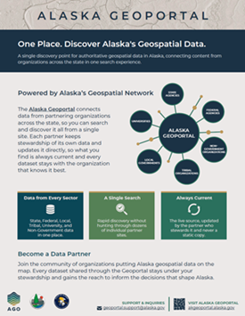
Alaska Geoportal: Discover Alaska's geospatial data
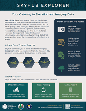
Skyhub Explorer: Your gateway to elevation and imagery data in Alaska
To modernize and coordinate Alaska's geospatial data by connecting partners across sectors, reducing duplication, and streamlining access, delivering the trusted, shared mapping foundation Alaska needs to make faster, smarter, and more cost-effective decisions.

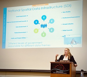
Our office serves as the connective tissue across sectors, coordinating government and non-government partners around a shared vision, shared goals, and shared spending. By streamlining access to information that already exists and reducing duplicated data collection, we help organizations save time and taxpayer dollars while accelerating the decisions that depend on reliable maps. To do this work, we administer the Alaska Geoportal, the state's central gateway to authoritative geospatial data, and Skyhub Explorer, an integrated remote sensing data hub. We also direct the Alaska Geospatial Council, a statewide coordinating body whose volunteer working groups advance our highest priorities: filling critical data gaps, implementing shared standards, building capacity through education and shared experience, and improving access to the foundational layers that underpin every basemap in Alaska.
A connected Alaska where authoritative geospatial data is openly shared, efficiently maintained, and readily accessible to all, equipping communities, agencies, and decision-makers with a complete and accurate picture of our state.
The Alaska Geoportal federates content from our Data Partners - local, state and federal governments, university and non-government organizations - into a single discovery point, so you can find the best available data for Alaska regardless of who publishes it.
Alaska benefits from an engaged, enthusiastic, and cooperative geospatial community working in all parts of the state. The Alaska Geospatial Council (AGC) coordinates across federal, state, and local government agencies as well as university, tribal, native corporation, and private-stakeholder groups to improve geospatial information availability and use. The AGO administers the Council, providing leadership and coordination for a sustainable geospatial framework consisting of policy, standards, technology and data.
Dr. Leslie Jones
Geospatial Information Officer
Phone: 907-269-5710
Email: leslie.jones2@alaska.gov