The Division of Geological & Geophysical Surveys (DGGS) is funded by the EPA to aggregate and make available to the public and agencies Alaska groundwater quality data for natural contaminants and create maps and data visualization tools to help land managers, agencies, developers, and the public make informed decisions when locating private and public wells intended to supply drinking water. New maps and tools for data visualization will also encourage the public to perform regular water tests on their private wells.
DGGS is a science-focused agency within the Department of Natural Resources. Its mission is to "determine the potential of Alaskan land for production of metals, minerals, fuels, and geothermal resources, the locations and supplies of groundwater and construction material, and the potential geologic hazards to buildings, roads, bridges, and other installations and structures" (AS 41.08.020). DGGS' goal is to provide unbiased scientific data and interpretations to answer important questions about the geology of the state, to benefit the health and welfare of all Alaskans. We partner with emergency coordinators, communities, private industry, agencies, and other stakeholders to provide timely information on imminent and long-term threats to the public and infrastructure, such as this Alaska Groundwater Quality Project. Alaska is challenged by poor water quality in some areas of the state, including health-concerning levels of arsenic, nitrate, and other contaminants, but very little is currently known about levels and locations of these contaminants. DGGS is interested to work with you, as stakeholders in groundwater quality information, to make information on natural contaminants in groundwater widely available.
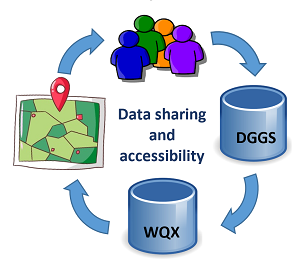
High-quality, timely, standardized data facilitate robust scientific modeling, public health studies, and new public outreach materials on a local and state scale to reduce exposure to contaminants. To significantly increase the amount, quality, security, and accessibility of Alaska groundwater quality data, DGGS will first build a network of Alaska groundwater data creators and users among state and federal agencies, universities, Alaska Native organizations, private citizens, and other stakeholders. These entities will identify sources of non-confidential groundwater quality data for natural contaminants, which DGGS will compile into a database for Alaska, to be submitted through the national Water Quality Exchange database (WQX).
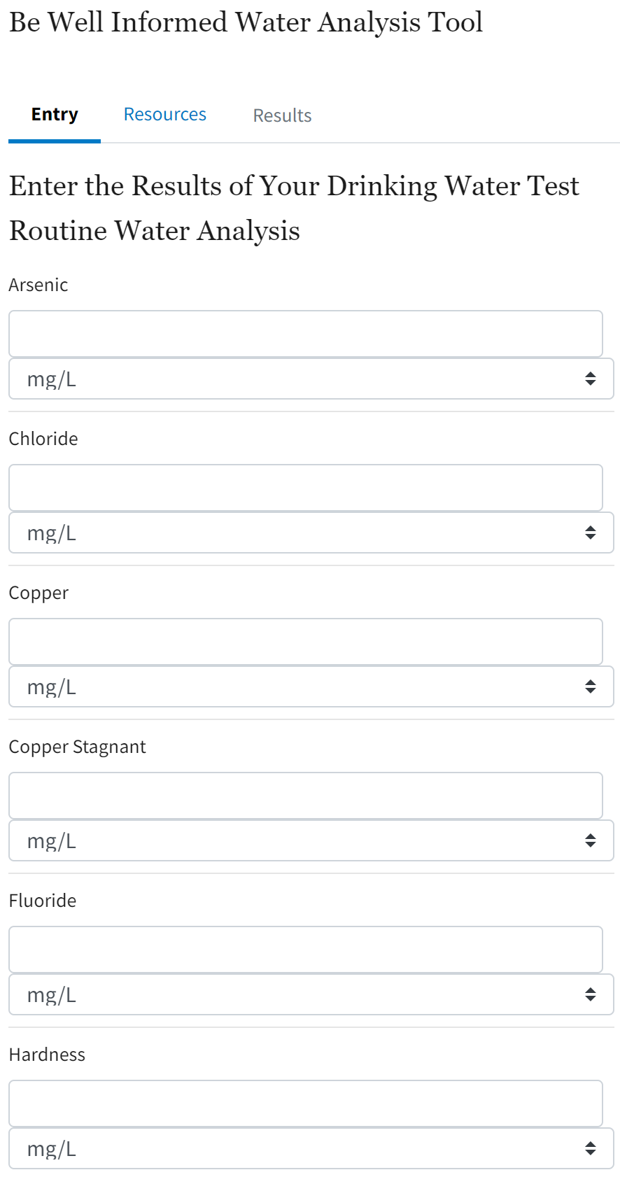
Most Alaska agency interactions with the public are currently reactive to the contamination of private well water, instead of proactively providing education and support to homeowners about regular testing. An Alaska version of the Be Well Informed tool will provide a customized interface for Alaska drinking water quality standards. DGGS will run a social media campaign to introduce the tool to Alaskans and use the communications to invite the public to submit private well water quality data to DGGS.
Example analytes of interest
New sources of Alaska groundwater quality data will help researchers and agencies make better decisions affecting the environmental, economic, and physical health of Alaskans. DGGS, with guidance from stakeholders, will develop a schema for a staging database in preparation for transferring non-confidential data to WQX.
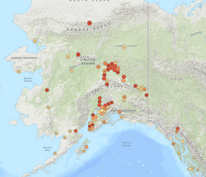
The Water Quality Portal provides a complicated interface to data in WQX. While some regulatory agencies have established workflows to utilize this raw water quality data in decision-making, many have not, and the public does not have a readily-accessible way to interpret this data on their own. DGGS will develop tools to aid in the visualization and interpretation of groundwater quality data with the aim of making these data available and approachable for non-technical users. The interface is anticipated to be similar to the Alaska Radon Map.


