Landslide hazards are a reality in Alaska and can drastically affect our communities and loved ones. Alaska Landslide Reporter is an app that allows you to be a citizen scientist and provide critical information about changing landscapes and landslide hazards. Your submission will give geologists crucial data to determine the potential risk and impact. Play an active role in keeping Alaskans safe from the dangers of landslides before they impact lives. Always maintain a safe distance from landslide hazards while making a report. If possible, take photos that show the entire magnitude of the landslide hazard and include a recognizable object for scale. Use Alaska Landslide Reporter and join our mission to keep Alaskans informed and safe.
What you'll need: A computer, mobile phone, or tablet AND just a couple of minutes!
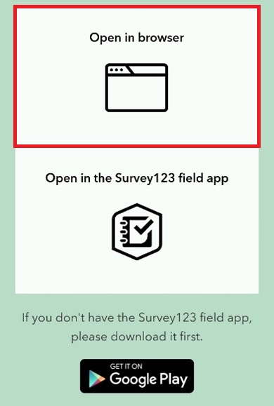
Begin by opening the Alaska Landslide Reporter on a computer or mobile device by scanning the QR code below. Scanning the QR code will allow you to open the survey in a browser or the ArcGIS Survey123 field app. For details on the Survey123 field app, see below Option B: Offline.

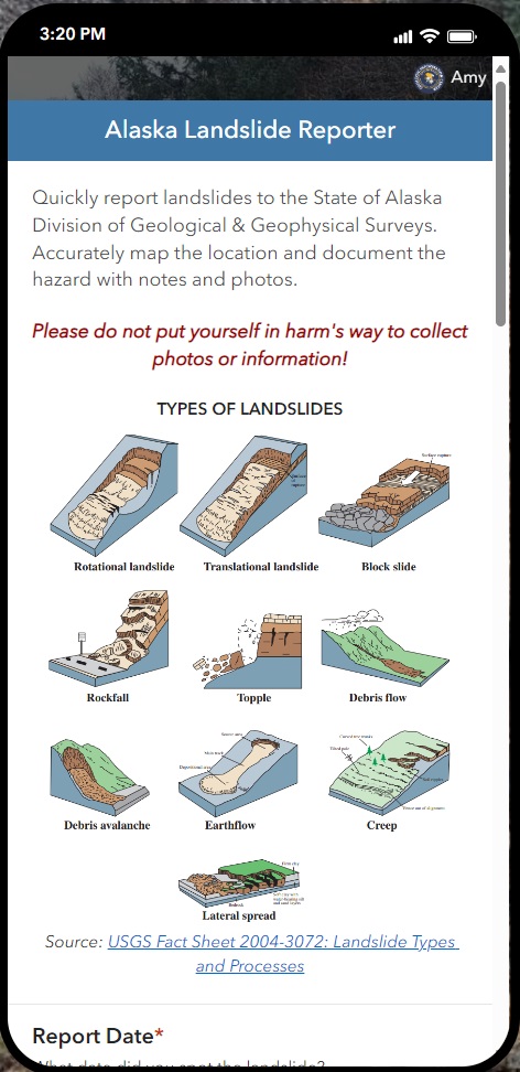
You will first see a series of landslide examples and a link to learn more about landslides.
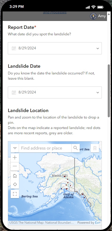
Next, you will fill in some basic information about the landslide: when you saw it, the date it occurred (if known), and where it occurred.
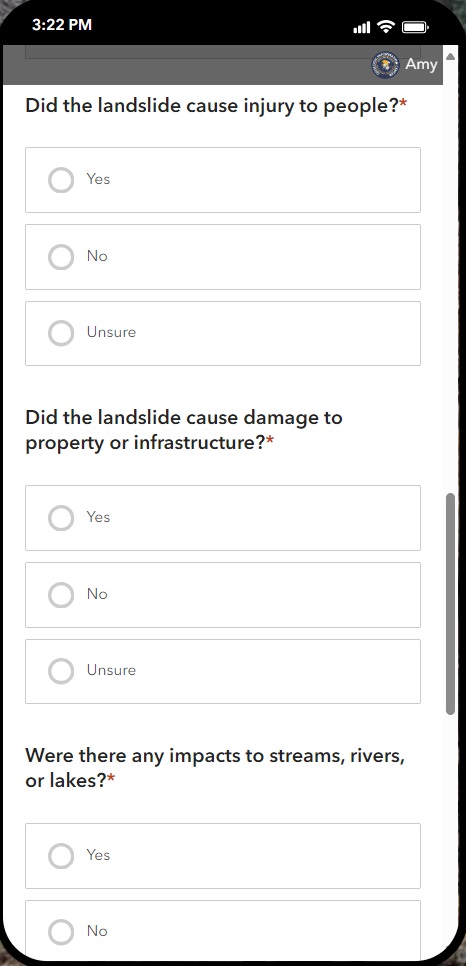
Then you will answer a few simple questions about damage caused by the slide. If you don't know the answer to these questions, then answer Unsure.
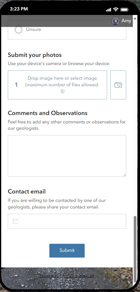
Optionally, you can add photos (remember to always stay safe and don't put yourself in danger to collect photos or information about a landslide). You can also add comments or other observations and a contact email if you are willing to be contacted by a DGGS geologist.
If you are regularly out of cell range and would like the option to collect landslide information while offline, you can download and install the ArcGIS Survey123 field app (free) for Android or iOS mobile devices.
Download from the Microsoft Store, App Store, or Google Play to get automatic updates.
After Survey123 is installed, open the app. You will prompted by the app to allow access to your camera, photos, and location. PLEASE NOTE: The exact order of these steps may differ between mobile operating systems and versions.
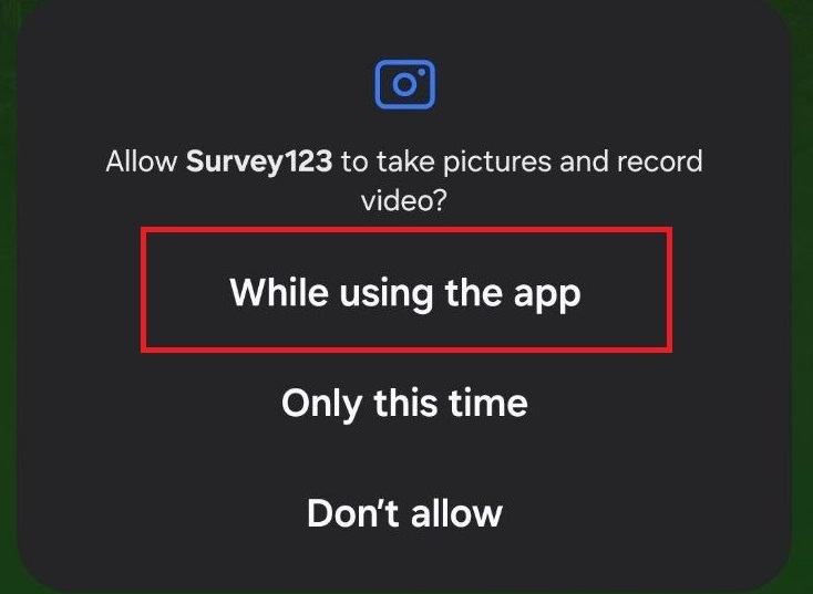
Android users: Select While using the app to allow Survey123 to take photos for data collection.
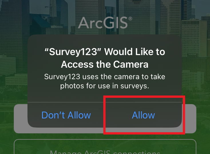
iOS users: Select Allow in order to submit photos of landslides to ArcGIS Survey123.
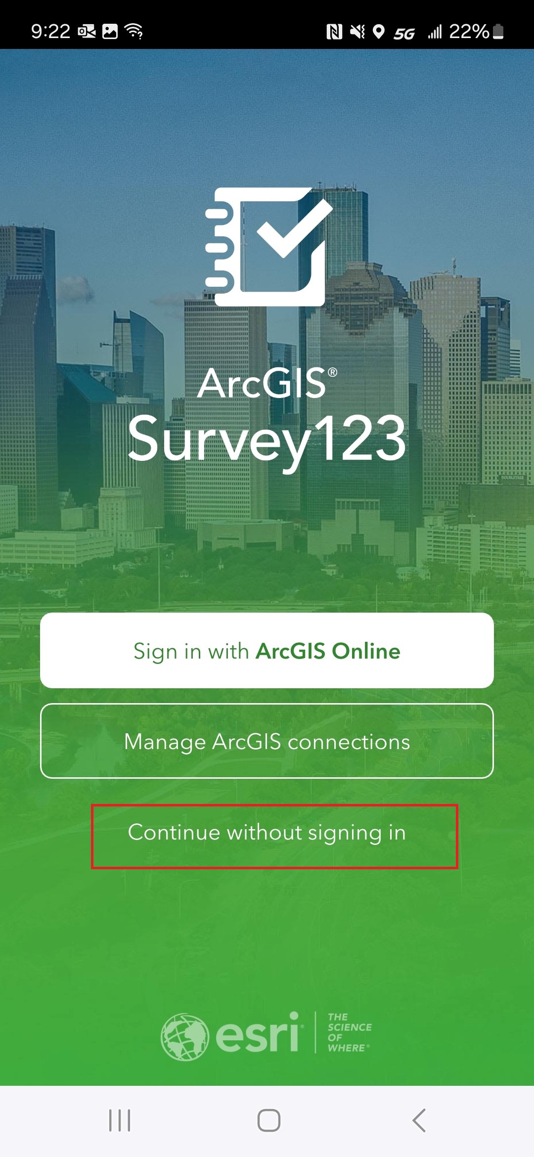
For all users, click Continue without signing in.
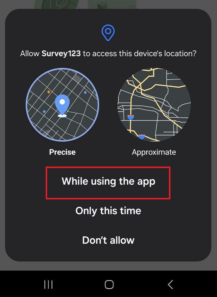
Android users: Select While using the app to allow Survey123 to access your device's location.
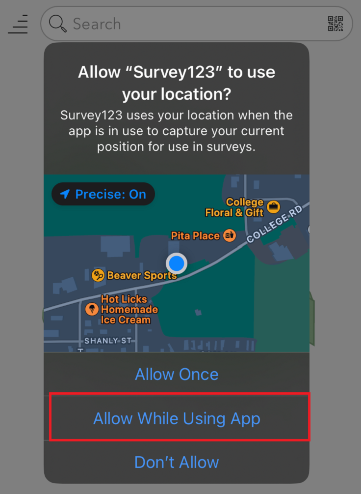
iOS users: Select Allow While Using App to allow Survey123 to access your device's location.
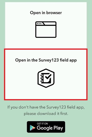
Scan the QR Code and select Open in the Survey123 field app.

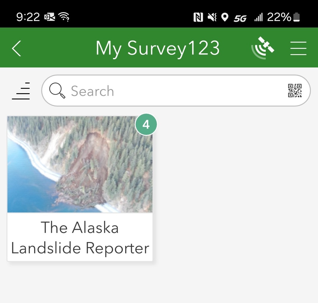
Adding The Alaska Landslide Reporter survey is a one-time action. The survey will remain in the app for you to use after the set-up process is completed.
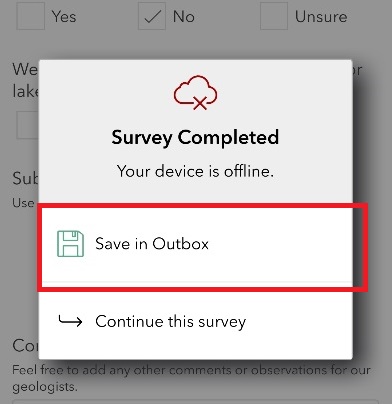
After the survey is completed, click Save in Outbox.
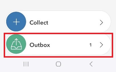
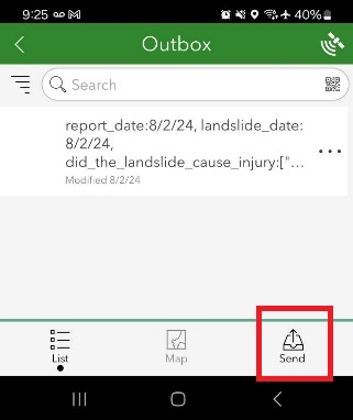
When you are back in cell range, open the app, click on Outbox, and then click Send on your report.