An earthquake occurs when two pieces of the earth's crust suddenly move past one another. The surface on which the earthquake occurs is known as a fault and the earthquake energy radiates from a point within the Earth known as a hypocenter. The point directly above the hypocenter on the Earth's surface is known as the epicenter. Scientists use the Moment Magnitude Scale to measure the sizes of earthquakes.
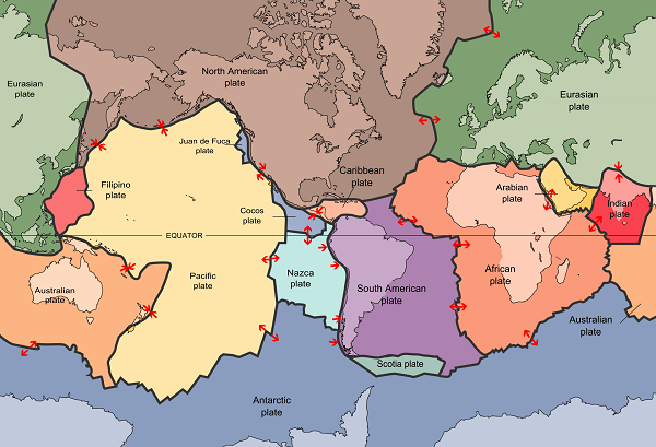
The Earth has a thin, brittle crust (much like the thin shell of an egg) that is broken into major pieces known as tectonic plates. Alaska is very close to the boundary between the Pacific and North American plates; the source of Alaska's frequent earthquakes. Forces from within the Earth cause the plates to continuously move, but they are stuck at the edges. When the forces moving the plates finally overcome the friction holding the edges of the plates together, the edges of the plates slip and seismic waves radiate outward and cause ground shaking.

The thick black lines on this map of the Earth outline tectonic plates in different colors. The North American plate in brown (at the top) contains Alaska. Small red arrows show the directions in which the plates are moving.

Sometimes earthquakes occur on faults under the ocean. If an earthquake disturbs the sea floor by shaking it up and down, then the earthquake energy can contribute to large waves at nearby coastlines, called a tsunami. See this page for more information about how tsunamis are generated.
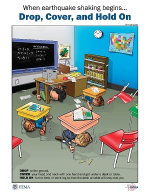
Can scientists predict earthquakes? No! Unfortunately not. Earthquake prediction is not possible (and may never be possible). But, while scientists continue to learn about why earthquakes happen when they do, you can make sure that you and your family, classmates, friends, teachers, and students know the proper steps to take before, during, and after the next big earthquake. Be prepared!