Flooding impacts many coastal communities in Alaska, yet the majority do not have a complete record of flood events. For this project, DGGS is compiling a list of all known floods for individual communities. The flood height is estimated using written accounts, photographs, historical and modern imagery, and elevation models. The current risk of flooding is determined by comparing historical flood extents to current infrastructure. Each community-specific report includes a flood risk category map showing current infrastructure and previous floods.
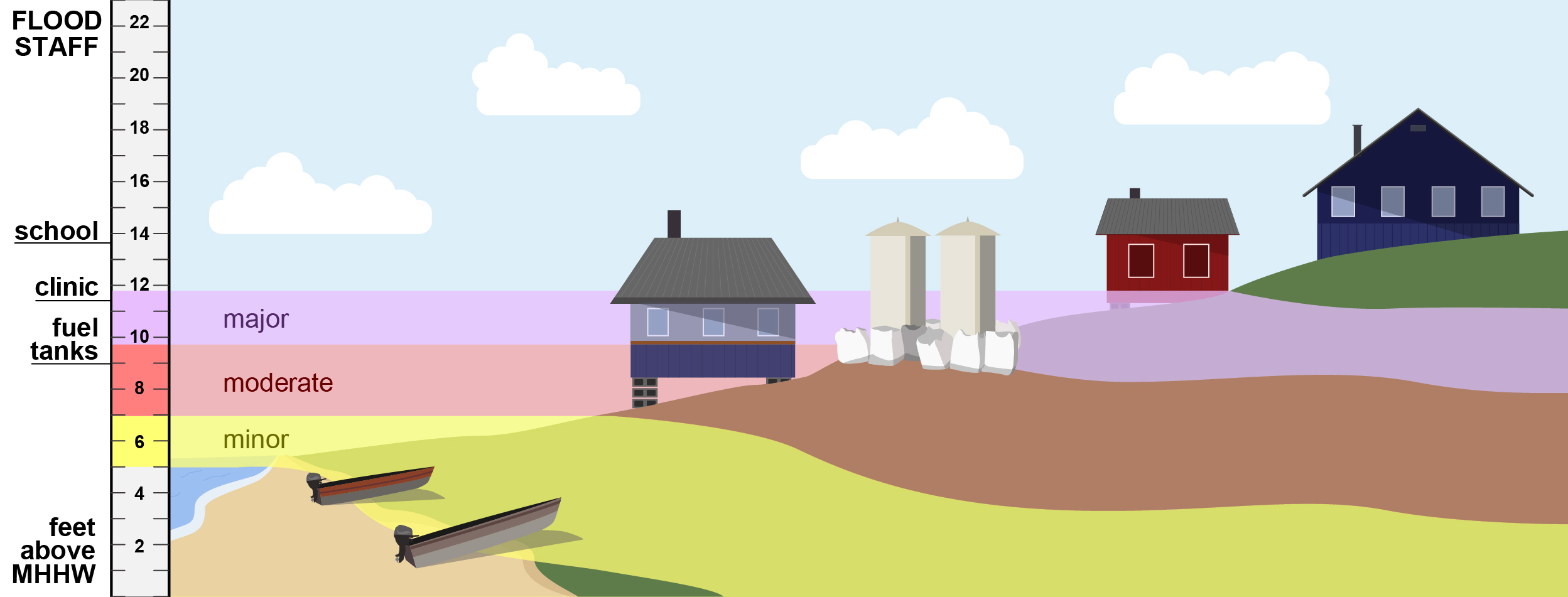
Flood risk category heights on an elevation staff (left) and contoured on a community.
DGGS has publications describing the overall project and results and methodology and is also developing an online tool to view flood risk categories, past flood extents, and current water level forecasts. Storm and flood photos are hosted on the DGGS Photo Database. DGGS has also created an Alaska Flood Observations Facebook Group to encourage more contributions of photographs that demonstrate flooding, statewide.
DGGS has published flood assessments for several communities, but more are in the works. Creating these maps requires a recently acquired elevation dataset tied to a tidal datum, and a great deal of effort goes in to estimating past storm heights.
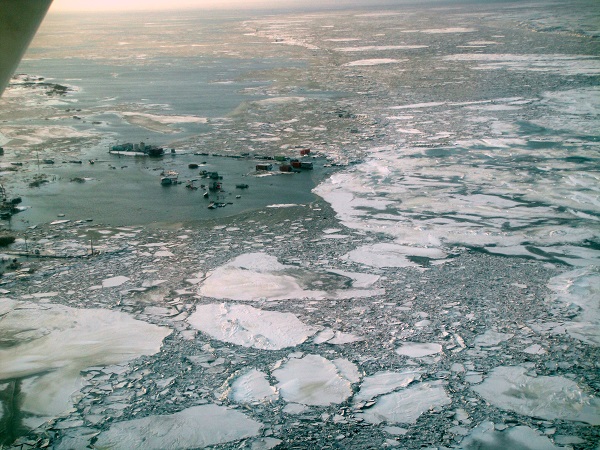
Flooding in Nunam Iqua during the November 2011 storm. Photo taken by Division of Homeland Security & Emergency Management.
This project is funded by the National Oceanic and Atmospheric Administration, Alaska Ocean Observing System, and the State of Alaska.
For more information, contact Nora Nieminski and access all the related reports.
Nora M. Nieminski
Coastal Hazards Program Manager
Phone: 907-754-3595
Email: nora.nieminski@alaska.gov