Many of Alaska's coastal communities are vulnerable to erosion, flooding, and permafrost degradation. However, few vulnerability assessment tools are available to the public that are complete or that utilize transparent, consistent, and quantitative methods at a scale needed for local planning. This report summarizes statewide analyses of long-term shoreline change at 48 Alaska communities.
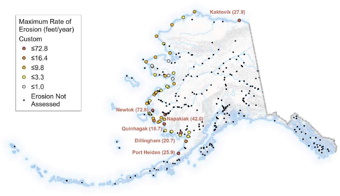
Summary map showing the maximum rate of erosion at the communities analyzed in the shoreline change report.
The full report and community-specific maps are available at https://doi.org/10.14509/30552.
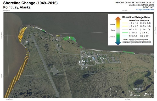
Clip of shoreline change map at Point Lay, Alaska
Nora M. Nieminski, Ph.D.
Coastal Hazards Program Manager
Phone: 907-754-3595
Email: nora.nieminski@alaska.gov