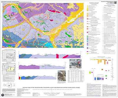
Sicard, K.R., Naibert, T.J., Hubbard, T.D., Twelker, Evan, Wypych, Alicja, Werdon, M.B., Willingham, A.L., Gillis, R.J., Lande, L.L., and Newberry, R.J., 2017, Geologic map of the Tok River area, Tanacross A-5 and A-6 quadrangles, eastern Alaska Range, Alaska: Alaska Division of Geological & Geophysical Surveys Preliminary Interpretive Report 2017-3, 15 p., 1 sheet, scale 1:63,360. https://doi.org/10.14509/29722
 Report Information
 Maps & Other Oversized Sheets
 Geospatial & Analytical Data
These data products comply with our published AK GeMS standard. Download the ak_gems_db product to receive the full AK GeMS database and associated files. Download the gems_db (a.k.a. fed_gems_db) product to receive the data converted into the GeMS standard published by the USGS. Download the gems_shp (a.k.a. fed_gems_shp) product to receive simple shapefile representations of the data. For further information see the AK GeMS Database Project Page.
| Geologic map of the Tok River area, Tanacross A-5 and A-6 quadrangles | Data File Format | File Size | Info |
|---|---|---|---|
| Download pir2017_003_tok_river_ak_gems_db_pkg | Vector data | 16.0 M | Metadata - Read me |
| Download pir2017_003_tok_river_gems_db_pkg | Vector data | 15.1 M | Metadata - Read me |
| Download pir2017_003_tok_river_gems_shapefile_pkg | Vector data | 5.3 M | Metadata - Read me |
Alluvium; Amphibolite; Arenite; Basalt; Bedrock; Bedrock Geologic Map; Bedrock Geology; Birch Creek Schist; Burnt Creek; Burnt Lake; Cathedral Rapids Fault; Chistochina Mining District; Clearwater Camp; Clearwater Creek; Colluvium; Conglomerate; Delta Mineral Belt; Devonian; DGGS; Diorite; Dolomite; Dry Tok Creek; Eagle Trail Wayside; Early Cretaceous; Engineering; Floodplain; Gelifluction; GeMS DB L3 Compliant; GeMS DB v1pt1; Geologic; Geologic Map; Geologic Materials; Geological Process; Geology; Geomorphology; geoscientificInformation; Glacial; Gneiss; Granodiorite; Graphite; Gravel; Greenschist; Greenstone; Hayes Glacier Belt; Hona Pluton; Hornblende; Igneous; Interpretation; Kalutna River; Landslide; Late Cretaceous; Late Jurassic; Little Tok River; Log Cabin Creek; Lost Creek; Macomb Subterrane; Marble; Mentasta Lake; Metals; Metamorphic; Metamorphism; Mineral Deposits; Mineral Localities; Mineral Prospect; Mineral Resources; Minerals; Mining; Mining Claims; Mississippian; Mudstone; Natohona Creek; Orthogneiss; Outwash; Permafrost; Plutons; Porphyry; Quartzite; Quaternary; Rhyodacite; Rock Units; Rocks; Sand; Sandstone; Schist; Shindata Creek; Sikonsina Pass; Siltstone; Skarn; Solifluction; STATEMAP Project; Station Creek; Stibnite Creek; Sulfides; Surface; Surficial; Surficial Geology; Talus; Tanacross; Tertiary; Thermokarst; Timber Creek; Tok; Tok Mining District; Tok River; Tok River Unit; Trail Creek; Triassic; Uplift; White Creek