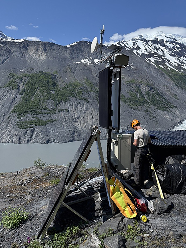
USGS Geoprevent colleague installing radar site telemetry upgrades in Barry Arm. Photo by S. Corbett, USGS.
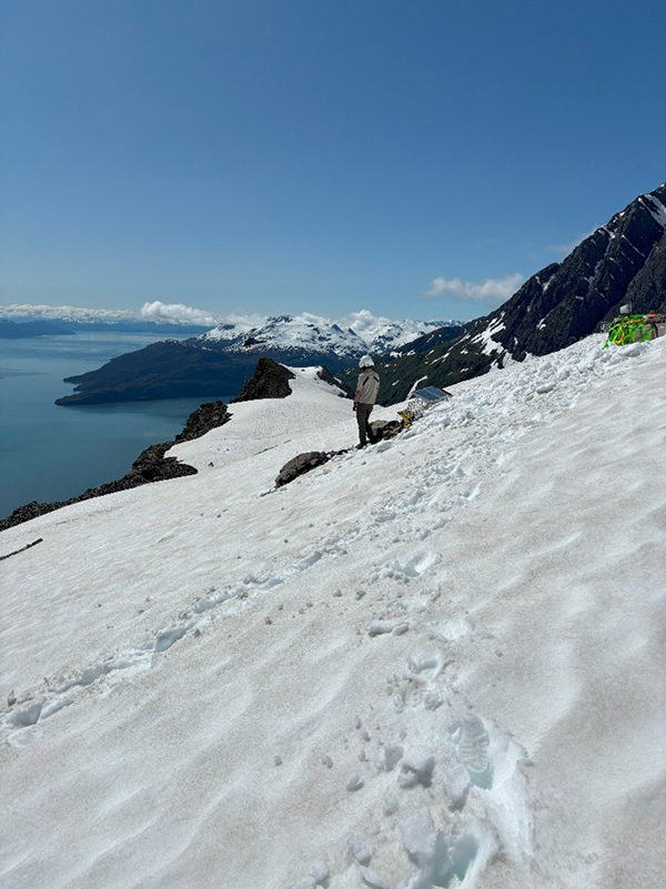
Preparing to sling down equipment from BAW, above the Barry Arm landslide. Photo by D. Staley, USGS.
An ongoing landslide and landslide-generated tsunami threat exists in Barry Arm, northwestern Prince William Sound, Alaska. The landslide is stable or exhibiting slow rates of deformation (<50 mm/d). Localized areas of higher velocities may be evident, but movement is largely surficial. While potential failure of these areas may result in a localized tsunami, failure is unlikely to represent a region-wide tsunami threat. Partial or catastrophic rapid failure is unlikely without external forcing, such as that associated with a strong regional earthquake. "Small" but infrequent rockfalls and shallow landslides may be commonly observed.
Mariners should remain vigilant when in the vicinity of Barry Arm or nearby waters and be prepared to depart the area if any unusual rockfall activity is seen or heard, or if unusual waves, currents, or tides are observed.
No recent fieldwork was conducted in Prince William Sound.
| Monitoring Method | Agency | Operational Status | Notes |
|---|---|---|---|
| Water Level | NTWC | Online | |
| Seismic - BAE | AEC | Online | |
| Seismic - BAT | AEC | Online | |
| Infrasound - BAEI | USGS | Online | |
| Ground-Based Radar | USGS | Online | |
| Deformation camera | USGS | Online | |
| Satellite InSAR and imagery | USGS | Online | |
| Hydrometeorology - BAE | DGGS | Online | |
| Hydrometeorology - BAW | DGGS | Online | |
| Hydrometeorology - Mt Doran | DGGS | Online |
(Last updated February 2, 2024)
The Barry Arm landslide is a large (~500 M m3 or 650 M yd3) landslide located in the northwestern corner of Prince William Sound, Alaska. Rapid failure of the landslide has the potential to create a tsunami that results in life-threatening waves and currents in Barry Arm, Harriman Fjord, Port Wells and adjacent fjords. The existence of the landslide is evident in photographs dating back to at least 1935, with possible evidence of the landslide in photographs dating to 1913.
Throughout the observational record, the Barry Arm landslide has experienced slow movement punctuated by episodes of acceleration. While slow downslope movement is both common and expected, rapid increases in the rate of movement may be a possible precursor to catastrophic failure. As such, observations and hazard messages are often centered around trends in the observed rates of downslope movement at Barry Arm, as measured by ground-based, aerial, and satellite surveillance methods.
The Barry Arm landslide is being monitored by a multiagency team of scientists from the U.S. Geological Survey (USGS), National Tsunami Warning Center (NTWC), Alaska Division of Geological & Geophysical Surveys (DGGS), and the University of Alaska Fairbanks Alaska Earthquake Center (AEC). For more information on monitoring activities, equipment and data availability, please visit https://landslides.usgs.gov/storymap/barry-arm/.
(Last updated February 2, 2024)
Scientists at USGS, DGGS, AEC, and NTWC will continue to make every effort to minimize outage of this critical network of sensors. The Alaska environment and its inhabitants can wreak havoc on our sites: strong winds can damage sensors, power components, and antenna; deep snow can bury instruments and solar panels and makes it difficult to access (and even find) sites, rain can work its way into sensitive electronics, and our four-legged neighbors, such as bear, deer, and goats, have a taste for our wiring and enclosures. While we have made our best effort to harden the sensors, power systems, and telemetry for continuous operation of the equipment and to resist weather and animals, it is necessary to have reasonable expectations given the difficulties of working in this harsh environment. Reasonable expectations include:
This message will be updated on January 2, 2026, or earlier if the threat level changes. For more information, please see our Barry Arm Summary Information & FAQ page.


