June 5, 2026
- During the week of May 11, scientists from the U.S. Geological Survey (USGS) and Alaska Division of Geological & Geophysical Surveys (DGGS) gathered at the Alaska Volcano Observatory (AVO) for a three-day workshop focused on the direct and cascading hazards of large, bedrock landslides, such as the one in Barry Arm and the recent landslide and tsunami in Tracy Arm. This collaborative effort is intended to provide a scientifically defensible method for assessing the potential for rapid catastrophic failure of slow-moving landslides, characterize their potential impact, and quantify the degree to which the dynamic Alaska environment affects their potential hazard now and in the future.
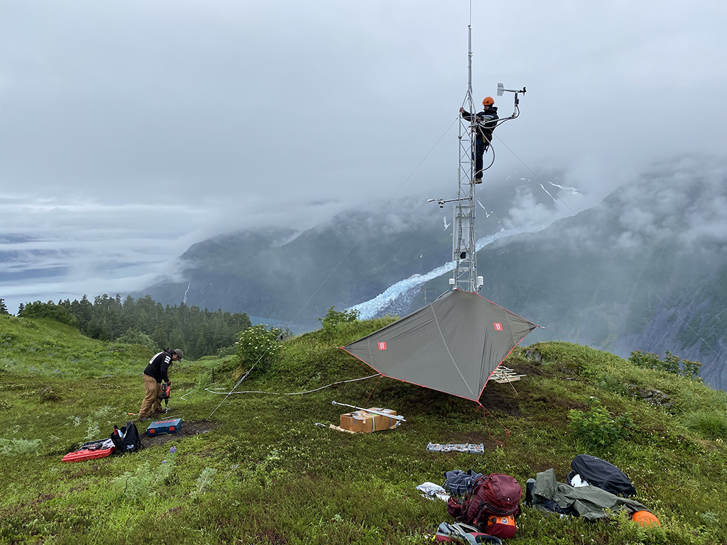
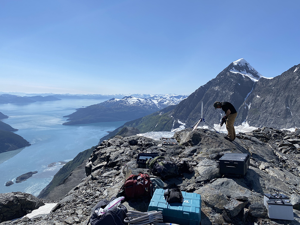
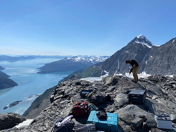
- During the week of May 18, scientists from the USGS completed the annual spring maintenance of the ground-based radar system in Barry Arm. We made several upgrades, including installing a new fuel cell and new batteries to improve function and connectivity over the winter months. This upgrade occurred alongside the annual tasks of swapping over the summer fuel supply and routine system checks.
- At the same time, staff from the National Tsunami Warning Center (NTWC) replaced a pressure sensor at the north shore tide site and improved the telemetry at Point Doran. Snow levels and weather did not permit access for the maintenance at the high elevation weather sites operated by DGGS. This maintenance has been rescheduled for later in the season.
May 1, 2026
- No new landslide status updates
- On April 28, 2026, science and operational staff from the U.S. Geological Survey and National Tsunami Warning Center conducted reconnaissance of instrumentation in Port Wells and Barry Arm to determine the physical health of equipment to inform maintenance and upgrade plans for field operations occurring throughout summer and fall 2026.
April 3, 2026
- No new landslide status updates
- No fieldwork or public events have occurred recently; however, planning has begun for the upcoming annual maintenance trip in May 2026.
March 6, 2026
- No new landslide status updates
- No fieldwork or public events have occurred recently; however, planning has begun for the upcoming annual maintenance trip in May 2026.
February 6, 2026
- No new landslide status updates
- No fieldwork or public events have occurred recently; however, planning has begun for the upcoming annual maintenance trips starting early spring 2026.
January 2, 2026
- No new landslide status updates
- No fieldwork planned for January due to winter weather.
December 5, 2025
- No new landslide status updates
- No recent fieldwork was conducted in Prince William Sound nor is planned for December 2025 due to winter weather.
November 7, 2025
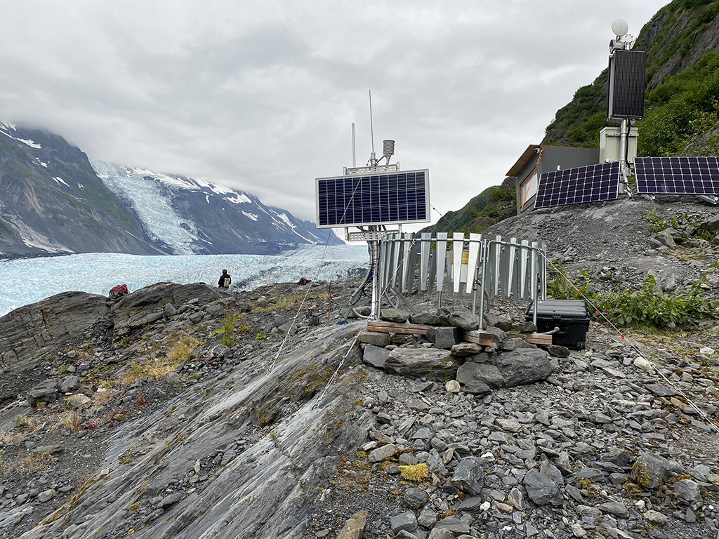
- USGS and DGGS scientists recently conducted routine maintenance at monitoring sites in Barry Arm.
- DGGS successfully recharged fluid in the all-season precipitation gauge, upgraded the software for data transmission, and backhaul decommissioned equipment.
- USGS scientists were able to address power supply issues and prepare the ground-based radar system for winter.
October 3, 2025
September 5, 2025
USGS and DGGS scientists recently conducted routine maintenance work at monitoring sites in Barry Arm.
- DGGS successfully re-established a radio link between a meteorological node and the main weather station on the east side of Barry Arm, removed damaged equipment, and performed health checks at two other meteorological sites.
- USGS scientists delivered fresh batteries to a campaign seismic array on the west side of Barry Arm, above the landslides.
August 15, 2025
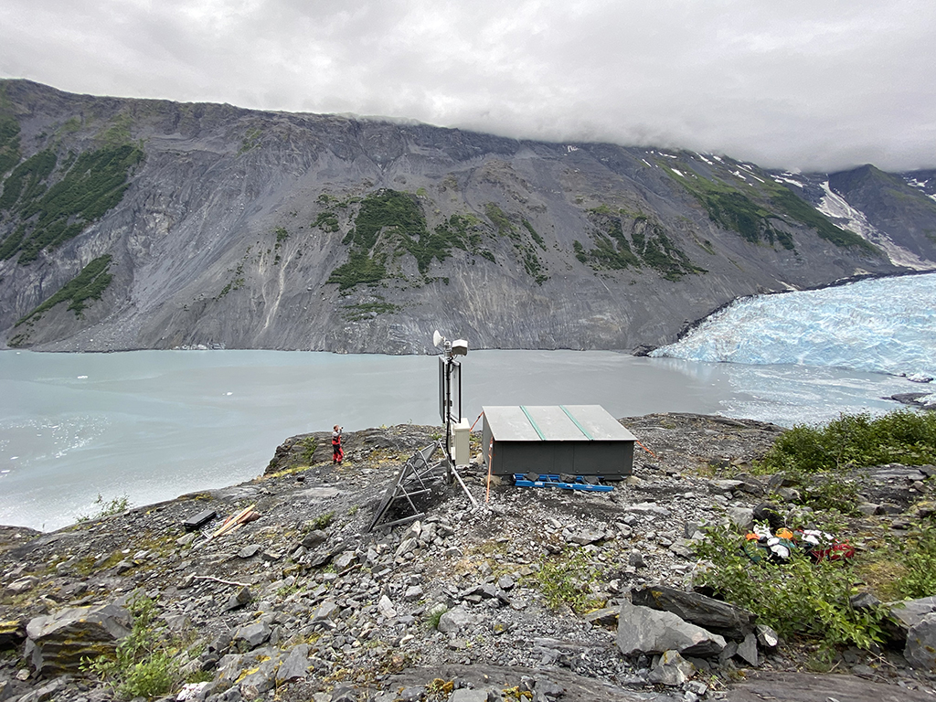
- Tracy Arm: A landslide above the toe of the South Sawyer Glacier failed into the waters of Tracy Arm, south of Juneau, Alaska, producing a tsunami on Sunday, August 10th, 2025, at 05:26 AKDT/13:26 UTC. No injuries or fatalities have been reported. Visit the USGS Event Page for additional information.
- Steep, mountainous landslide scarps are inherently unstable and will continue to change in the years following the main landslide. Continued rockfall and smaller scale landslide events from the exposed landside scarp are expected, could impact the water, and could cause future local displacement waves.
August 1, 2025
- No Barry Arm landslide status updates
- The U. S. Geological Survey (USGS) recently upgraded the ground-based radar telemetry system to improve connectivity over the winter months. Scientists also replaced damaged equipment in the BAE infrasound array, downloaded data from campaign installs, replaced batteries, and re-installed cameras with Alaska Earthquake Center (AEC) technical staff.
- Scientists from the Division of Geological & Geophysical Surveys (DGGS) deconstructed broken equipment and repaired meteorological stations.
July 3, 2025
- No new landslide status updates
- Engineers from the National Tsunami Warning Center are still working on repairs to the tide sensor at Whittier Harbor.
- USGS scientists and project colleagues are still planning fieldwork in July for a series of annual summer repairs at sites that still need to melt out from being buried all winter. Tasks include telemetry upgrades, repair or replacement of damaged equipment, refreshing power supplies, and other routine preventative maintenance at remote sites.
June 6, 2025
- No new landslide status updates
- Engineers from the National Tsunami Warning Center completed repairs to the power supply system at the Port Wells tide site
- USGS scientists conducted annual repairs and maintenance on the ground-based radar replacing multiple critical hardware components
- USGS scientists also installed a campaign infrasound array in Barry Arm to collect data over the summer
May 2, 2025
- No new landslide status updates
- Engineers from the National Tsunami Warning Center have completed repairs to the tide sensors in Whittier Harbor and Port Wells
- Fieldwork is planned for May 20-22nd in Prince William Sound to perform annual spring site maintenance and to upgrade to the ground-based radar system and the Port Wells tide sensor.
April 4, 2025
- No new landslide status updates
- Engineers from the National Tsunami Warning Center have completed repairs to the tide sensors in Whittier Harbor and Barry Arm and are working on reestablishing data connections and power to the Port Wells sensor.
- On April 2nd scientists from the U.S. Geological Survey (USGS) conducted maintenance operations in Barry Arm on the ground-based radar and the repeater site at Mount Doran.
March 7, 2025
- No new landslide status updates
- Recent changes in operational policies at partnered Federal agencies have resulted in delays in equipment repairs and service renewals essential to maintaining full operational readiness. We are working closely with agency leadership to address these challenges and minimize impacts to emergency preparedness and response operations.
- Engineers have been working to diagnose outages and develop plans to repair critical monitoring systems
- Scientists and engineers will perform a maintenance trip to ground-based radar system, repeater site, and the sea-level sensors at Point Doran, North Short of Barry Arm, and Esther Passage as soon as schedules allow, and conditions permit
February 7, 2025
- No new landslide status updates
- Engineers have completed repairs to the tide sensor in Whittier Harbor
- Scientists recently conducted routine maintenance operations in Barry Arm. Highlights include: 1) Re-establishment of telemetry to the DGGS hydrometeorological sites on the east and west side of the Barry Arm fjord;
2) Manual download of hydrometeorological data that were stored locally during the telemetry outage; 3) Repair of equipment and sensors damaged by the high wind events of mid-January; 4) Re-establishment of telemetry to the ground-based radar system used to measure landslide movement
January 3, 2025
- No new landslide status updates
- Highlights of this summer season include:
- Installation of a temporary 4-element infrasound array in Yale Arm to perform a preliminary characterization of mass movement activity on several slow-moving landslides in the area
- Routine maintenance of multiple meteorological stations in the vicinity of Barry Arm that will allow us to better characterize the environmental conditions that may contribute to hillslope instability
- Routine maintenance of a ground-based radar system in Barry Arm that is used to measure slow rates of movement across the Barry Arm landslide
- Routine maintenance of a network of water level sensors that are used to detect a wave generated by failure of the Barry Arm landslide for warning purposes
- Geologic and structural mapping in multiple locations throughout southwestern Prince William Sound that will allow us to better understand the geologic controls on the regional distribution of landslides
- Installation of temporary seismometers in Barry Arm and Yale Arm for the purpose of characterizing the depth of potential sliding surfaces and their geometry and the seismic signals associated with slow landslide movement
- Outreach activities in Whittier, Alaska
- In addition to fieldwork, scientists from the USGS, DGGS, AEC, and U.S. National Park Service travelled to Norway in mid-September to meet with colleagues at the Norwegian Geological Survey to exchange insights, experiences, and ideas related to monitoring large, slow-moving landslides in sub-arctic environments and characterizing their hazard
December 6, 2024
- No new landslide status updates
- Installation of a temporary 4-element infrasound array in Yale Arm to perform a preliminary characterization of mass movement activity on several slow-moving landslides in the area
- Routine maintenance of multiple meteorological stations in the vicinity of Barry Arm that will allow us to better characterize the environmental conditions that may contribute to hillslope instability
- Routine maintenance of a ground-based radar system in Barry Arm that is used to measure slow rates of movement across the Barry Arm landslide
- Routine maintenance of a network of water level sensors that are used to detect a wave generated by failure of the Barry Arm landslide for warning purposes
- Geologic and structural mapping in multiple locations throughout southwestern Prince William Sound that will allow us to better understand the geologic controls on the regional distribution of landslides
- Installation of temporary seismometers in Barry Arm and Yale Arm for the purpose of characterizing the depth of potential sliding surfaces and their geometry and the seismic signals associated with slow landslide movement
- Outreach activities in Whittier, Alaska
November 1, 2024
- No new landslide status updates
October 4, 2024
- No new landslide status updates
September 6, 2024
- Part of the "Kite" area of the landslide exhibited increased motion after heavy rain in mid-August but the motion has since stopped. The remainder of the landslide is not undergoing any widespread deformation but smaller-scale instabilities on the surface of the landslide still pose a threat of localized tsunami generation in Barry Arm. Mariners transiting near Barry Arm should remain vigilant.
August 2, 2024
- No new landslide status updates
- Instrumentation with AEC and University of Utah, August 8-12, based in Whittier
- Heli-based mapping out of Valdez August 13-17
- Boat-based mapping out of Whittier August 19-22
July 12, 2024
- No new landslide status updates
- DGGS/USGS staff deployed infrasound and seismic sensors in Yale Arm fjord for short-term surveillance
- DGGS/USGS performed routine maintenance on weather stations and other instrumentation in Barry Arm fjord
- DGGS/USGS performed a helicopter-borne ice-penetrating radar survey on Barry Glacier to measure the thickness and internal structure of the glacier
June 7, 2024
- No new landslide status updates
- June 24 - 26: Instrumentation maintenance in Barry and Yale Armsli
- June 27 - July 1: Reconnaissance of a select number of landslides described in Schaefer et al., 2024, Satellite interferometry landslide detection and preliminary tsunamigenic plausibility assessment in Prince William Sound, southcentral Alaska: U.S. Geological Survey Open-File Report 2023-1099, 22 p., https://doi.org/10.3133/ofr20231099
- July 2 - 3: Instrumentation maintenance in Barry Arm
May 3, 2024
- No new landslide status updates
- The USGS and NTWC will be conducting fieldwork out of Whittier May 9 - 12 to perform ground-based radar and tide sensor maintenance
- Representatives from the USGS and DGGS will be attending the Prince William Sound Natural History Symposium in Whittier May 13-14. Join us on Monday, May 13 for a "Coffee with Scientists" event at 5:30pm at the Lazy Otter Cafe
- The Prince William Sound Regional Citizens' Advisory Council will be hosting a Vessel Operator Tsunami Hazards Guidance workshop in Valdez, June 3-4
April 5, 2024
- No new landslide status updates
- Upcoming fieldwork: Plans are in the works to harden telemetry connections to achieve more robust connectivity with the radar site and tide sensors during the next weather window and as team members are available. If time and conditions permit, the team will also attempt to restore power at the BAT seismic site. Exact timing of trip is still TBD.
March 1, 2024
- No new updates
- No upcoming fieldwork planned
- Recent publications:
- Schaefer, L.N., Kim, J., Staley, D.M., Lu, Z., and Barnhart, K.R., 2024, Satellite interferometry landslide detection and preliminary tsunamigenic plausibility assessment in Prince William Sound, southcentral Alaska: U.S. Geological Survey Open-File Report 2023-1099, 22 p., https://doi.org/10.3133/ofr20231099.
- Schaefer, L. N., Coe, J. A., Wikstrom Jones, K., Collins, B. D., Staley, D. M., West, M., et al. (2023). Kinematic evolution of a large paraglacial landslide in the Barry Arm fjord of Alaska. Journal of Geophysical Research: Earth Surface, 128, e2023JF007119, https://doi.org/10.1029/2023JF007119.
- Higman, B., Lahusen, S.R., Belair, G.M., Staley, D.M., and Jacquemart, M., 2023, Inventory of Large Slope Instabilities, Prince William Sound, Alaska: U.S. Geological Survey data release, https://doi.org/10.5066/P9XGMHHP.
February 2, 2024
- An ongoing landslide and landslide-generated tsunami threat exists in Barry Arm, northwestern Prince William Sound, Alaska. The landslide currently appears stable and is exhibiting only slow rates of deformation (<50 mm/d). Localized areas of higher velocities may be evident, but movement is largely surficial. While potential failure of these areas may result in a localized tsunami, failure is unlikely to represent a region-wide tsunami threat. Partial or catastrophic rapid failure is unlikely without external forcing, such as that associated with a strong regional earthquake. "Small" but infrequent rockfalls and shallow landslides occurring on the landslide's surface may be commonly observed.
January 5, 2024
December 1, 2023
November 3, 2023
October 6, 2023
September 1, 2023
August 14, 2023
July 7, 2023
June 2, 2023
May 5, 2023
- The National Tsunami Warning Center (NTWC) is installing water-level gauges in Esther Passage and Whittier to improve communication in northwest Prince William Sound and to monitor water-level changes in real time.
- Join U.S. Geological Survey and NTWC representatives on May 15 for "Coffee with Scientists" from 5-7 pm at the Lazy Otter Cafe in Whittier. The informal discussions will focus on local landslide and tsunami monitoring and the current status of the Barry Arm landslide. E-mail info@princewilliamsound.org for additional details.
- The fifth annual Prince William Sound Natural History Symposium will take place on Tuesday, May 16, 2023 at the Whittier Public Safety Building and online via Zoom. The theme this year is "Resilience: Perseverance and Tenacity in Prince William Sound," and will focus on topics including landslides, glaciers, land management, cultural history, and ecology. Visit 2023 NATURAL HISTORY SYMPOSIUM | PWSSF (princewilliamsound.org) for registration and more information.
April 7, 2023
March 3, 2023
February 3, 2023
January 6, 2023
December 2, 2022
November 10, 2022
- The landslide began slowing on October 13, 2022, with all widespread motion stopping on November 8, 2022.
- It is unknown if the landslide will reactivate again in the coming weeks or months.
- Despite the halt in movement, the landslide remains a hazard to recreationalists, marine traffic, infrastructure, and important natural and cultural resources in northwestern Prince William Sound.
- Previous analyses revealed widespread movement of the Barry Arm landslide beginning on August 21, 2022, with rates of movement ranging from 50 mm to >100 mm (2 to >4 inches) per day.
- The interagency team will continue to monitor the landslide and the water beneath it with existing instrumentation and satellite data. Tsunami warning capability is being tested, but not yet available.
- Full interagency information statement.
November 4, 2022
- Due to the ongoing hazard, we ask people to exercise their best judgement and, where possible, limit travel in the Barry Arm area, including Harriman Fjord, Barry Arm, College Fjord, and upper Port Wells.
- We still see continued deformation and movement in the Barry Arm landslide as reported on September 16. Scientists at the U.S. Geological Survey, the Alaska Division of Geological & Geophysical Surveys, and the National Tsunami Warning Center have suspended non-essential boat-based operations and will continue to monitor the landslide movement and provide further details on Friday, November 11, unless significant changes warrant earlier updates.
October 28, 2022
- Due to the ongoing hazard, we ask people to exercise their best judgement and, where possible, limit travel in the Barry Arm area, including Harriman Fjord, Barry Arm, College Fjord, and upper Port Wells.
- We still see continued deformation and movement in the Barry Arm landslide as reported on September 16. Scientists at the U.S. Geological Survey, the Alaska Division of Geological & Geophysical Surveys, and the National Tsunami Warning Center have suspended non-essential boat-based operations and will continue to monitor the landslide movement and provide further details on Friday, November 4, unless significant changes warrant earlier updates.
October 21, 2022
- Due to the ongoing hazard, we ask people to exercise their best judgement and, where possible, limit travel in the Barry Arm area, including Harriman Fjord, Barry Arm, College Fjord, and upper Port Wells.
- We still see continued deformation and movement in the Barry Arm landslide as reported on September 16. Scientists at the U.S. Geological Survey, the Alaska Division of Geological & Geophysical Surveys, and the National Tsunami Warning Center have suspended non-essential boat-based operations and will continue to monitor the landslide movement and provide further details on Friday, October 28, unless significant changes warrant earlier updates.
October 14, 2022
- Due to the ongoing hazard, we ask people to exercise their best judgement and, where possible, limit travel in the Barry Arm area, including Harriman Fjord, Barry Arm, College Fjord, and upper Port Wells.
- We still see continued deformation and movement in the Barry Arm landslide as reported on September 16. Scientists at the U.S. Geological Survey, the Alaska Division of Geological & Geophysical Surveys, and the National Tsunami Warning Center have suspended non-essential boat-based operations and will continue to monitor the landslide movement and provide further details on Friday, October 21, unless significant changes warrant earlier updates.
October 7, 2022
- Due to the ongoing hazard, we ask people to exercise their best judgement and, where possible, limit travel in the Barry Arm area, including Harriman Fjord, Barry Arm, College Fjord, and upper Port Wells.
- We still see continued deformation and movement in the Barry Arm landslide as reported on September 16. Scientists at the U.S. Geological Survey, the Alaska Division of Geological & Geophysical Surveys, and the National Tsunami Warning Center have suspended non-essential boat-based operations and will continue to monitor the landslide movement and provide further details on Friday, October 14, unless significant changes warrant earlier updates.
September 30, 2022
- Due to the ongoing hazard, we ask people to exercise their best judgement and, where possible, limit travel in the Barry Arm area, including Harriman Fjord, Barry Arm, College Fjord, and upper Port Wells.
- We still see continued deformation and movement in the Barry Arm landslide as reported on September 16. Scientists at the U.S. Geological Survey, the Alaska Division of Geological & Geophysical Surveys, and the National Tsunami Warning Center have suspended non-essential boat-based operations and will continue to monitor the landslide movement and provide further details on Friday, October 7, unless significant changes warrant earlier updates.
September 23, 2022
- We still see continued deformation and movement in the Barry Arm landslide as reported on September 16. Scientists at the U.S. Geological Survey, the Alaska Division of Geological & Geophysical Surveys, and the National Tsunami Warning Center have suspended non-essential boat-based operations and will continue to monitor the landslide movement and provide further details on Friday, September 30, unless significant changes warrant earlier updates.
September 16, 2022
- The spatial extent of the area currently moving within the Barry Arm landslide has increased since initial motion was detected on August 23. Movement now includes the entirety of the "Kite," and large portions of the "Prow" and "Core."
- The U.S. Geological Survey, Alaska Division of Geological & Geophysical Surveys, and the National Tsunami Warning Center have indefinitely postponed Barry Arm fieldwork requiring water access.
- Movement in these parts of the landslide is common, but current rates of motion are at or above the range of rates that have been measured since 2020.
- The thickness of material that is moving is currently unknown.
- This ground motion does not mean that a failure will occur. However, it is notable because of the areal extent of motion, elevated rates of motion, and that the portion of the landslide experiencing movement is right above the water.
- If the part of the landside that is currently moving fails rapidly, anyone in the immediate vicinity, including Barry Arm and Harriman Fiord, would face a life-threatening tsunami. Dangerous currents and onshore impacts would be expected in Port Wells, Blackstone Bay, Cochrane Bay, Passage Canal, and in Whittier, Alaska.
- The interagency team will continue to monitor the landslide area and the water beneath it with existing instrumentation and satellite data.
- Full interagency information statement
September 9, 2022
- We are still seeing continued deformation and movement in "the Kite" as reported on August 26 and September 2. Scientists at the U.S. Geological Survey and Alaska Division of Geological & Geophysical Surveys will continue to monitor the landslide movement and provide further details on Friday, September 16, unless significant changes warrant earlier updates.
September 2, 2022
- We are still seeing continued deformation and movement in "the Kite" as first reported on August 26. Scientists at the U.S. Geological Survey and Alaska Division of Geological & Geophysical Surveys will continue to monitor the landslide movement and provide further details on Friday, September 9, unless significant changes warrant earlier updates.
August 26, 2022
- Beginning August 23, 2022, new ground surface movement has been observed in a 0.42 square km (0.16 sq mi) portion of the Barry Arm landslide referred to as "the Kite." The current movement is up to 50 mm (2 in) per day.
- The thickness of material that is moving is currently unknown.
- This ground motion does not mean that a failure will occur. However, it is notable because this portion of the landslide is right above the water.
- If this portion of the landslide fails, anyone in the immediate vicinity, including Barry Arm and Harriman Fjord, would face a life-threatening tsunami. It is NOT expected that the impacts of a failure would create significant inundation in nearby communities such as Whittier, Alaska-- though damage could be possible in harbors and marinas, along with strong and unusual currents that make navigation difficult or impossible for several hours.
- The interagency team will continue to monitor the landslide area and the water beneath it with existing instrumentation and satellite data. Tsunami warning capability is being tested, but not yet available.
- Full interagency information statement
August 5, 2022
- Previous analysis from late June 2022 revealed up to 11 cm (4.3 in) of movement on a one-half square mile area of the Barry Arm landslide immediately above the terminus of Barry Glacier.
- A recent analysis of satellite imagery from July shows that the rate of movement has slowed or ceased.
- It is unknown if this motion will be renewed in the coming weeks or months.
- The interagency team will continue to monitor the landslide area and the water beneath it with existing instrumentation and satellite data. Tsunami warning capability is being tested, but not yet available.
- Full interagency information statement
July 1, 2022
- Satellite analysis from the last month revealed up to 11 cm (4.3 in) of movement on a one-half square mile area of the Barry Arm landslide immediately above the terminus of the Barry Glacier.
- The depth of the movement is currently unknown. We do not know if this type of movement is common as this is the first motion detected since direct monitoring began.
- It is unknown if this motion will continue.
- The interagency team will continue to monitor the landslide area and the water beneath it with existing instrumentation and satellite data. Tsunami warning capability is being tested, but not yet available.
- Full interagency information statement
June 3, 2022
- The Prince William Sound Science Symposium recording from May 23 is now available. Dr. Dennis Staley (USGS) and Dave Snider (NTWC) present information on Barry Arm.
- NTWC repaired experimental tsunami water-level stations and outfitted them with better communication and power hardware.
- USGS remobilized the ground-based synthetic aperture radar unit in Barry Arm and performed maintenance on the nearby camera system and repeater site. The purpose of the radar is to measure fine scale deformation of the Barry Arm landslide, which can help researchers understand the rate, timing, and spatial extent of landslide motion. In addition to helping answer some of the fundamental science questions related to the Barry Arm landslide, the radar will provide situational awareness for the National Tsunami Warning Center (NTWC) and other state and local emergency management agencies. Information related to changes in the spatial extent of landslide deformation and increased rates of landslide movement will help inform emergency management plans and outreach activities intended to reduce public exposure to a possible tsunami generated by a partial or complete failure of the Barry Arm landslide. The ground-based radar will be deployed until mid-October, when it will be removed for the winter as a result of significant avalanche hazard at the site.
- DGGS conducted routine maintenance and repair of meteorological instruments, camera equipment, and the repeater site in Barry Arm.
May 6, 2022
- The Prince William Sound Stewardship Foundation will host their fourth annual Natural History Symposium on May 23rd. This free day-long community event brings together the latest in news and research from around Prince William Sound. The Symposium will take place from 9 AM to 5:30 PM online and in person at the Whittier Public Safety Building, and recordings of all sessions will be available in June. Please visit princewilliamsound.org for more information.
April 8, 2022
- Snowpack at Barry Arm remains heavy. Typical spring avalanche activity is causing telemetry issues with several instruments. As soon as the snow recedes and the avalanche danger subsides, a multi-agency effort will be made to assess any damage and bring all instruments back online.
April 1, 2022
March 4, 2022
February 4, 2022
- On February 2, Dennis Staley of the U.S. Geological Survey (USGS) and Katreen Wikstrom Jones of the Alaska Division of Geological & Geophysical Surveys (DGGS) visited several instrument sites in Barry Arm fjord to clear solar panels and realign cameras. Severe winter winds and heavy snow necessitated the mid-season visit.
January 7, 2022

Tyler Stokes drills a hole for a soil temperature probe and Gabriel Wolken adjusts the camera at the meteorological station BAE on the east side of Barry Arm fjord. Cascade Glacier and part of the Barry Arm landslide are visible in the background. Photo credit: Katreen Wikstrom Jones, DGGS.
Tyler Stokes drills a hole for a rock anchor at node BAWN4. This rock/soil and air temperature node is located 1,289 m above sea level (asl) on the west side of Barry Arm fjord directly above the landslide headscarp. Photo credit: Katreen Wikstrom Jones, DGGS.
Node BAEN1, co-located with the USGS terrestrial radar hut, is on the east side of Barry Arm fjord at 193 m asl. This node is equipped to measure precipitation amount and intensity. Photo credit: Katreen Wikstrom Jones, DGGS.
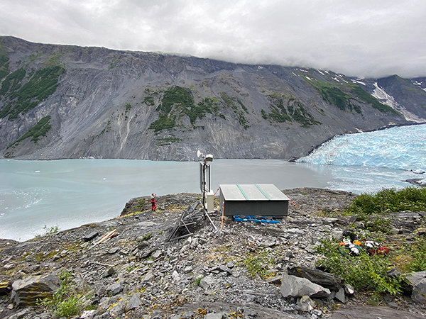
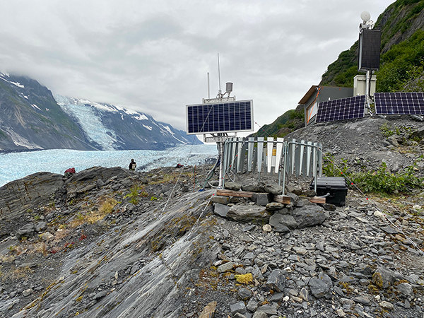
Ground based radar site in Barry Arm, installed to measure landslide movement. Photo credit: U.S. Geological Survey.
December 3, 2021
- The U.S. Geological Survey (USGS) ground-based radar station was removed from the east side of Barry Arm on October 17, 2021 to avoid winter avalanche hazards. This winter, data collected between July 28 and October 17 will be analyzed to identify any trends in small-scale landslide activity. The ground-based radar station will be re-installed as soon as avalanche danger in the area subsides--likely in the May/June 2022 timeframe.
- In early November, 2021, The Alaska Division of Geological & Geophysical Surveys (DGGS) performed scheduled weather station and soil node maintenance to prepare all nine instrument stations for winter operation.
- In October, 2021, DGGS collected nearshore bathymetric data along the main landslide body in upper Barry Arm.
- In August, 2021, DGGS conducted a repeat lidar survey of the entire Barry Arm slide area.
- The most recent satellite-based InSAR analyses from the USGS have not detected any significant movement in the Barry Arm landslide area. Because of snow cover, it will likely be Spring 2022 before there are any additional satellite-based observations.
- The Alaska Volcano Observatory (AVO) infrasound array remains operational heading into winter. No concerning signals have been detected.
November 5, 2021
- Weather permitting, the Alaska Division of Geological & Geophysical Surveys (DGGS) and the National Tsunami Warning Center (NTWC) will perform planned maintenance on Barry Arm instrument stations in November.
- In October, the U.S. Geological Survey (USGS) released results of simulated inundation in Whittier, Alaska resulting from the largest wave-generating scenario considered in their 2021 Barry Arm report:
- Approximately 20 minutes after the hypothetical landslide, simulated water levels rise to about 3 to 6 feet (about 2 meters) above MHHW level on dry land with offshore waves in the 3 to 6 foot (about 2 meters) range. Waves of this height create strong currents, can mobilize debris, and have the potential to cause significant damage.
- Recall that for this landslide scenario, peak wave heights top over 650 feet (about 200 meters) in the northern part of Barry Arm fjord.
- For reference, after an earthquake, the National Tsunami Warning Center will issue a Tsunami Warning beginning with a 3 foot (1 meter) tsunami. A Tsunami Warning means a tsunami with the potential to generate widespread inundation is imminent, expected, or occurring. Powerful currents are possible and may continue for several hours after initial wave arrival.
- Please refer to the "Ongoing Hazards" section below for maritime guidance.
October 22, 2021
- Beginning November 4, regular website and listserv updates will be issued on a monthly basis. Other important announcements or threat level changes will still be issued here when appropriate.
August 27, 2021 through October 8, 2021
August 13, 2021
- Analysis of satellite-based radar data reveals no detectable landslide motion for the period spanning 15 July through 8 August.
- The Alaska Division of Geological & Geophysical Surveys (DGGS) completed a high-resolution lidar survey that will be used for further landslide structural mapping and fine-scale change detection.
- DGGS also installed nine new instrument stations in the Barry Arm area: six nodes with soil moisture and temperature probes, two full meteorological stations, and one repeater station. Instruments are co-located with existing equipment where possible and will provide a suite of data for monitoring changes in soil/air moisture and temperature, precipitation, snowpack, and solar intensity.
- The U.S. Geological Survey (USGS) installed a ground-based radar and a camera across from the Barry Arm landslide. These instruments can be used to make very precise measurements of landslide movement.
- The USGS also conducted detailed mapping of the rock characteristics in western Prince William Sound, with measurements obtained at more than 45 locations. At each site, USGS scientists made measurements of rock mass quality, rock type, and geological characteristics. The data collected during the mapping effort will be used in the analysis of regional rock-slope hazards in Prince William Sound.
- The USGS performed maintenance of the infrasound array in Whittier. This equipment might help detect low-frequency sounds related to landslide activity indicating an increased tsunami threat.
- The National Tsunami Warning Center (NTWC) performed maintenance on water level sensors in the vicinity of Barry Arm. These sensors are designed to measure pressure from the passage of large waves and support development of a real-time tsunami warning system for nearby communities. However, the warning system is not yet operational.
July 30, 2021
- The U.S. Geological Survey (USGS) announced the release of new landslide-generated tsunami models for Prince William Sound (PWS) in the event of a Barry Arm slide failure. Note that although these model results suggest a landslide-generated tsunami may be less severe than previously thought, potential wave heights and currents may still be hazardous to nearshore communities, port entrances, marinas, and boatyards throughout PWS. If you have a boat, please see the "Ongoing Hazards" section below for general recommendations for recreational and commercial boaters.
July 16, 2021
- Only July 11, the Alaska Earthquake Center (AEC) repaired a communications issue at station BAE across the fjord from the landslide. Real-time seismic data and hourly camera images from this location have been restored. The field team also retrieved some, but not all, of the equipment destroyed on the slide itself this spring.
- The State of Alaska and the City of Whittier will host an Emergency Preparedness Outreach event on Wednesday, July 21 in Whittier.
July 2, 2021
- U.S. Geological Survey (USGS) landslide researchers visited the Barry Arm area for reconnaissance on June 15-17. The group focused on preliminary rock mass quality tests and site selection for a ground-based radar monitoring system. Fieldwork is scheduled to resume at the end of July.
- The USGS and the Alaska Earthquake Center (AEC) will replace the seismometer on the Barry Arm landslide that was destroyed in late April, 2021. The new site will be on the ridge between the landslide and Cascade Glacier and is to be co-located with an Alaska Division of Geological & Geophysical Surveys (DGGS) meteorological station.
June 18, 2021
June 4, 2021
May 21, 2021
- Aerial reconnaissance on May 13 confirmed that the Alaska Earthquake Center (AEC) seismic station located on the Barry Arm slide was destroyed in late April. The most probable cause was a snow avalanche. The seismic station and webcam across the fjord remain under heavy snow load. We anticipate the return of these data once the solar panels are fully exposed and the system has time to recharge.
May 7, 2021
- The National Tsunami Warning Center (NTWC) installed three water level gauges in Barry Arm during the last week of April, 2021. Data from each sensor is flowing to the NTWC but the warning system is *NOT* yet operational. Design and testing are underway and it will likely be several weeks before a warning system is active.
April 23, 2021
- The National Tsunami Warning Center (NTWC) will install water level monitoring equipment in Barry Arm from April 26 to 30 to support an early warning system for tsunami events.
April 9, 2021
- The Alaska Division of Geological & Geophysical Surveys (DGGS) conducted a repeat lidar scan and made several ground-based snowpack measurements to map snow distribution and calculate snow water equivalent in the Barry Arm area.
- The National Oceanic and Atmospheric Administration (NOAA) Coast Survey is conducting previously planned bathymetric surveys in Port Wells and near Whittier. This activity is not directly related to the Barry Arm landslide tsunami risk but may yield helpful data.
March 26, 2021
- The Alaska Volcano Observatory (AVO) infrasound array in Whittier is operational and returning real-time data. No signals from the Barry Arm area were detected by the automated alarm or in manual reviews of the data. The array does continue to pick up anthropogenic noise from the Whittier tunnel and town.
- The Alaska Earthquake Center (AEC) seismic station on the landslide continues to send real-time data. No significant changes in seismicity have been observed.
- The AEC seismic station and camera across the fjord remain out of communication, likely a result of snow blocking the radio link.
- Planning is underway for multi-agency fieldwork this summer to address the Barry Arm landslide and tsunami hazard.
March 12, 2021
- On March 6th, The Alaska Volcano Observatory (AVO) field crews shored-up power to the Whittier infrasound array, improving signal characteristics. The data quality is currently good.
- The City of Whittier performed maintenance on and tested their existing tsunami siren this week and is investigating adding a second alert siren.
- The Alaska Department of Homeland Security & Emergency Management (DHS&EM) provided the City of Whittier with new tsunami evacuation signage.
February 26, 2021
February 12, 2021
- On February 9, The Alaska Volcano Observatory (AVO) installed an infrasound (microphone) array in Whittier to assist with monitoring the landslide. After a calibration period, this array could aid in a future real-time warning system.
- The Alaska Division of Geological & Geophysical Surveys (DGGS) published high-resolution elevation data of the Barry Arm landslide collected on June 26, 2020.
- The U.S. Geological Survey (USGS) published a structure map of landslides at Barry Arm, identifying various slope and geologic features. The mapping utilized elevation data recently published by DGGS. The landslide structures and movements shown on this map will be used to monitor landslide evolution and help estimate landslide volumes for tsunami modeling.