Mission statement: The Hydrology Program mission is to lead research efforts that focus on understanding the interaction between geology, surface water, and groundwater impacting resource development and communities in dynamic settings.
Goal: To map, analyze, and understand the quantity and quality of surface water and groundwater resources in the state of Alaska.
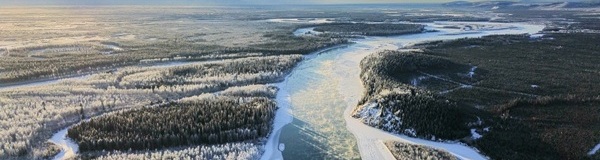
Braided channels of the Mathews River in the Brooks Range near Wiseman
Alaska covers 17% of the total area of the total area of the United States but contains 40% of the nation's freshwater resources. Alaska's heterogenous landscape ranges from temperate rainforests to arctic deserts, producing hydrologic regimes that contrast widely across the state due to variations in temperature, precipitation, glaciation, and permafrost distribution. The Hydrology Program seeks to understand how these dynamic processes control hydrologic systems in Alaska. Surface water provides an abundant resource for transportation, hydropower, and various industries beneficial to Alaskans. The strong connection between permafrost and groundwater makes constraints on the current and future distribution of permafrost critical for evaluating the quantity and quality of groundwater available for multiple state priorities. Hazards associated with groundwater and surface water, including landslides, aufeis, and flooding, effect numerous Alaskans each year and require interdisciplinary analysis to understand these complex, unpredictable events.
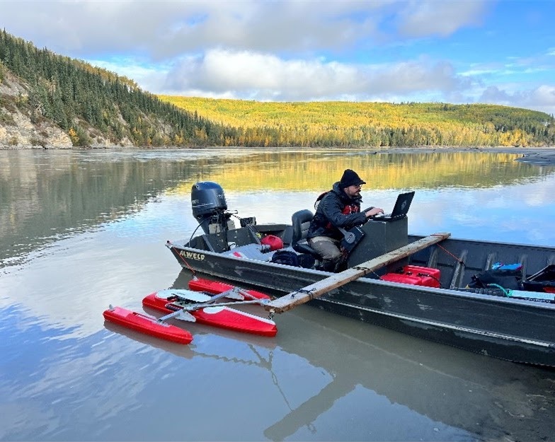
Measuring flow using an acoustic doppler current profiler on the Tanana River near Fairbanks
The Hydrology Program utilizes various analytical approaches to better understand surface water and groundwater systems across Alaska. These techniques include analysis of high resolution satellite and aerial imagery, airborne and ground-based geophysics and acoustics data, boreholes and wells, and other hydrologic datasets, ultimately producing computer models from the limited amount of available data. We collaborate with scientists and professionals from numerous disciplines and institutions to gain a better understanding of Alaska's water resources.
Hydrology is a part of almost all DGGS work involving surface materials because it influences surface processes, material characteristics, and landforms. Hydrologic instrumentation (weather stations, snow gauges, and stream gauges) and analysis supports many programs and projects at DGGS, ranging from the Haines Landslide Hazard Analysis project to the Arctic Strategic Transportation and Resources (ASTAR) project.
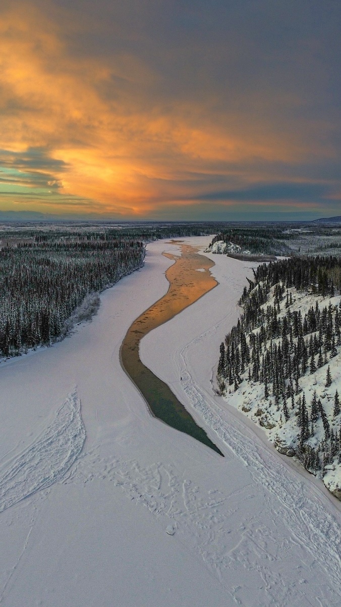
Kinetic energy prevents ice-formation on the Tanana River near Fairbanks. The same energy can be captured to provide electricity rural communities.
The Renewable Hydropower Program aims to quantify and map the state's hydrokinetic energy resources. Hydrokinetic (HK) energy refers to the energy generated by the natural movement of water in tides and rivers. As opposed to hydroelectric energy, which refers to electricity generated from turbines placed below reservoirs, HK energy does not require dams, artificial channels, or other run-of-river structures and diversions. Instead, turbines are placed directly in the ocean or natural river channel to capture energy generated by currents. Until recently, HK turbines have been difficult to connect to existing power grid infrastructure, and harsh sediment, debris, and seasonal ice conditions in Alaska have made year-round operation challenging.
Due to Alaska's unique geography and abundant water resources, hydrokinetic energy production provides an opportunity to make Alaska's energy infrastructure more resilient, affordable, and sustainable. Many remote villages currently get their power from aging diesel generators, which are expensive to operate and maintain. These same communities are often located along large energy-dense rivers, making them ideal locations for in-river HK energy production. Harvesting this local energy resource has the potential to offset large amounts of diesel fuel that must be imported, stored, and consumed. With continuing advancements in the HK industry, the Renewable Hydropower Program aims to inventory, map, and model Alaska's theoretical and practically recoverable in-river hydrokinetic energy resources. The program's goal is to invite further collaboration, research, and development within an emerging industry, which will directly benefit Alaskans through increased access and ownership of this sustainable energy resource.
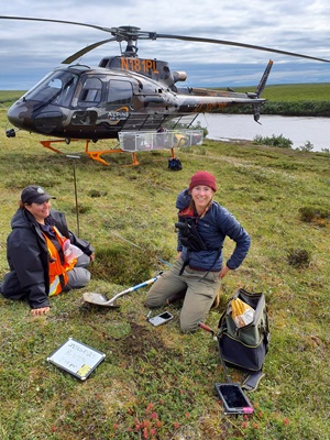
Point Lay field work 2024, ASTAR project
As part of the Arctic Strategic Transportation and Resources (ASTAR) infrastructure plan, the Triangle Community Road project focuses on the development of a year-round gravel road in the North Slope Borough, connecting the communities of Utqiagvik (Barrow), Wainwright, and Atqasuk to improve access to goods and services. To address the impact of hydrologic systems on road development, the Hydrology & Surficial Geology (HydroSurf) team installed a network of stream gages, weather stations, and snow sensors along the Triangle Community Road (Germann et al., 2024) to provide first-order constraints on stream discharge and surface runoff. Stream discharge and stream bed profiles were also measured at gage sites (Germann and Daanen, 2022) to serve as references for the field instruments.
For the next phase of the project, the HydroSurf team will expand the role of the field instruments and stream and surface field measurements. Radio repeaters will be installed to transmit stream and weather data in near-real time to document year-round correlations between precipitation, surface runoff, and discharge. Each year, stream discharge will be measured at gage locations using an Acoustic Doppler Current Profiler to check for consistency between field discharge and stream gage data and to help establish a stage-discharge relationship. Drone imagery and lidar data will be collected at proposed bridge crossings to establish baseline data for tracking surface changes, including streambank erosion, slope failure, and permafrost degradation. Shoreline data will also be collected to assess the risk of coastal road erosion from large storm events.
The Triangle Community Road project provides a unique opportunity to utilize stream and surface analyses to help plan road development and conduct scientific research of complex hydrologic systems on the North Slope.
Jamie T. Buscher
Hydrology Program Manager
Phone: 907-269-6557
Email: jamie.buscher@alaska.gov


