The Alaska Division of Geological & Geophysical Surveys collects and processes lidar (Light Detection and Ranging) to support the Division's geologic mapping and geologic hazard investigations. Our custom lidar system, designed for small-area collections, and a suite of geospatial software enable us to economically produce centimeter-accuracy digital terrain models (DTMs) of the bare earth surface, even in areas with thick vegetation.
Using the lidar data, scientists can identify unstable slopes such as landslides and debris flows and fault surface expressions. Additionally, with repeat surveys, staff can measure land surface changes, such as ground displacement.
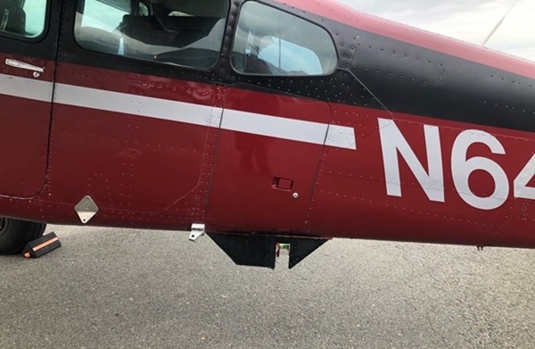
DGGS lidar scanner mounted beneath a Cessna 180 Skywagon
DGGS has been using lidar to evaluate slope instability in Barry Arm, changes in snow distribution, and potentially active faults. An essential component of our lidar program is the ability to quickly collect lidar data following slope instability events such as the landslides in Haines and Ketchikan. This enabled us to provide critical information to assist emergency personnel in making informed decisions regarding safety in the aftermath of these events.
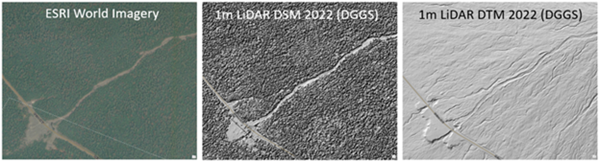
An example of surface details obscured by vegetation and revealed by lidar
Trent D. Hubbard
Hydrology & Surficial Geology Section Chief
Phone: 907-451-5009
Email: trent.hubbard@alaska.gov