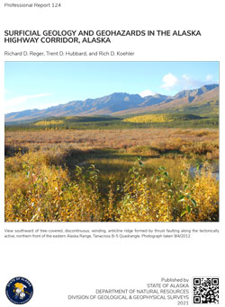
Reger, R.D., Hubbard, T.D., and Koehler, R.D., 2021, Surficial geology and geohazards in the Alaska Highway corridor, Alaska: Alaska Division of Geological & Geophysical Surveys Professional Report 124, 149 p., 18 sheets, scale 1:63,360. https://doi.org/10.14509/29701
 Report Information
 Maps & Other Oversized Sheets
 Geospatial & Analytical Data
These data products comply with our published AK GeMS standard. Download the ak_gems_db product to receive the full AK GeMS database and associated files. Download the gems_db (a.k.a. fed_gems_db) product to receive the data converted into the GeMS standard published by the USGS. Download the gems_shp (a.k.a. fed_gems_shp) product to receive simple shapefile representations of the data. For further information see the AK GeMS Database Project Page.
| Surficial geology and geohazards in the Alaska Highway corridor | Data File Format | File Size | Info |
|---|---|---|---|
| Download pr124_ak_hwy_surficial_ak_gems_db_pkg | Database files | 32.5 M | Metadata - Read me |
| Download pr124_ak_hwy_surficial_gems_db_pkg | Database files | 30.8 M | Metadata - Read me |
| Download pr124_ak_hwy_surficial_gems_shapefile_pkg | Shapefile | 63.8 M | Metadata - Read me |
Active Fault; Aerial; Aerial Geology; Aerial Photography; Alaska Range; Alluvial; Alluvial Deposits; Arrow Creek; Bear Creek; Bedrock Geology; Berry Creek; Cathedral Rapids; Chief Creek; Chisana Mining District; Chisana River; Cockscomb Creek; Colluvial Deposits; Colluvium; Debris Flow; Debris Flow Deposits; Delta Junction; Delta River; Delta River Mining District; Deltaic Facies; Dry Creek; Engineering; Engineering Geologic Map; Engineering Geology; Environmental; Eolian; Esker; Faulting; Faults; Flood; Floodplain; Floodplain Alluvium; Fluvial; Fortymile Mining District; Gardiner Creek; Gelifluction; GeMS DB L3 Compliant; GeMS DB v1pt1; geoscientificInformation; Gerstle River; GIS; Glacial; Glacial Deposits; Goodpaster Mining District; Granite Creek; Granite Mountain; Gravel; Hajdukovich Creek; Holocene; Johnson River; Lacustrine; Lacustrine Sedimentation; Lake George; Landslide Deposits; Late Pliocene; Liquefaction; Loess; Long Lake; Macomb Plateau; Midway Lake; Moon Lake; Moraines; Northway; Outwash; Outwash Fan; Paludal; Permafrost; Pingos; Pleistocene; Radiocarbon Ages; Radiocarbon Dating; Robertson River; Rock Glaciers; Sand; Sand and Gravel; Sawmill Creek; Sheep Creek; Slope; Stuver Creek; Surficial; Surficial Geologic Map; Surficial Geology; Talus; Tanana River; Tertiary; Tetlin Junction; Thaw Lakes; Thawing Permafrost; Thermokarst; Tok; Tok Mining District; Tok River; Tower Bluffs; Unconsolidated Deposits; Undifferentiated Bedrock; Yukon-Tanana Upland


