Alaska's heterogenous landscape ranges from temperate rainforests to arctic deserts. Hydrologic regimes contrast widely across the state due to variations in temperature, precipitation, glaciation, and permafrost distribution. Surface water provides an abundant resource for industries, transportation, and hydropower. Because permafrost and groundwater are strongly linked, DGGS works to gain a better understanding of current and future permafrost distribution, which is used to evaluate the quantity and quality of groundwater available for multiple state priorities. DGGS also evaluate hazards associated with groundwater and surface water, including landslides, aufeis, and flooding. The DGGS Hydrology Program utilizes a suite of tools to better understand surface water and groundwater systems across Alaska. These tools include remote sensing of the surface through high resolution satellite and aerial imagery, airborne and ground-based geophysics and acoustics, boreholes and wells, and physically based computer models to extrapolate from the limited amount of available data.
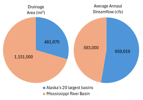
Due its landscape, climate, and geography, Alaska contains a disproportionate volume of freshwater resources - and 40% of all river energy in North America (Johnson and Pride, 2012). To put this in perspective, Alaska's 20 largest rivers drain about one-third the area of the Mississippi River Basin, although those 20 basins have a combined flow larger than the Mississippi. USGS gauges at these 20 sites report an average of 162 trillion gallons of runoff per year, enough to fill 245 million Olympic swimming pools.
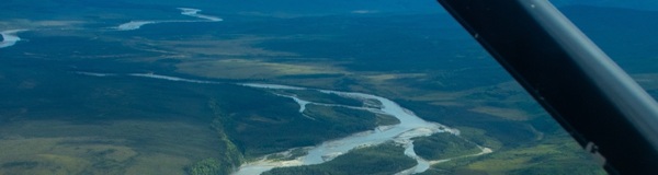
Looking up the Susitna River towards its headwaters in the Hayes Range
Alaska's surface water systems are vast and diverse, featuring a wide array of rivers, lakes, and wetlands. The distribution of precipitation that originates from the Pacific and Arctic oceans is controlled by the coastal ranges, the Arctic Brooks Range, and the continent's highest peaks situated in the Alaska and Wrangell-St. Elias Ranges. The state's geography and various climate zones influence the nature, volume, and distribution of the state's rivers.
Alaska is home to some of the largest unregulated rivers in the United States, including the Yukon and Copper rivers. Hundreds of rural communities located off the state's highway system rely on these rivers for transportation, commerce, and subsistence activities. Alaska is also home to more than 3 million lakes, many of which were formed by past and present glaciers or by permafrost thaw and subsidence. Lakes and rivers can remain locked in ice for over half the year, further influencing hydrologic regimes across different regions of the state.
Aufeis (icing) in Goldstream Valley near Fairbanks, Alaska
Groundwater flows through aquifers formed by glacial and alluvial deposits primarily composed of sand, gravel, and silt, or through fractures and faults in the underlying bedrock. Permafrost present throughout much of the state can form a solid barrier to groundwater flow, which leads to complex hydrologic dynamics. This permafrost barrier can cause artesian conditions where groundwater becomes pressurized beneath the frozen ground, resulting in fast-flowing springs that can cause localized flooding and aufeis development. Surface water and groundwater levels are often linked, with elevated groundwater levels typically occuring 1–3 weeks later than peak surface water levels. This groundwater rise can be extreme, especially in low lying areas such as North Pole, Alaska, where cellars can fill with water weeks after river flooding has subsided.
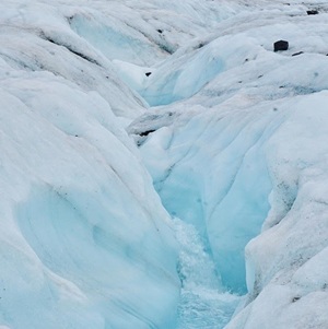
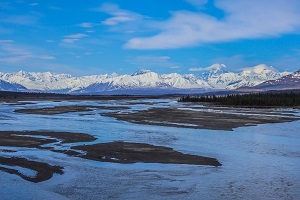
Surface-melt streams forming on the Gulkana Glacier near Paxson
Alaska is home to more than 100,000 glaciers, which collectively store a significant portion of the continent's freshwater. These glaciers are key indicators of climate change, with many experiencing rapid retreat due to rising temperatures. Glacial meltwater contributes significantly to surface streamflow and groundwater recharge. Glaciers play important roles in shaping both the local geography and hydrological cycles, storing winter precipitation in perennial snow and ice fields, and providing seasonal freshwater inputs to rivers and lakes in warmer months.
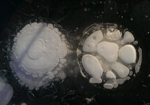
Methane bubbles in lake ice
Permafrost is a unique feature of Alaska's landscape, covering approximately 85% of the state's land area. By definition, permafrost refers to any soil, rock, or sediment that remains frozen for at least two consecutive years. Permafrost significantly affects the hydrologic system by limiting surface infiltration and groundwater flow, ultimately altering groundwater-surface water dynamics. The thawing of permafrost can lead to land subsidence, creating thermokarst landscapes that impact ecosystems. Permafrost degradation is a critical concern in the context of climate change, as it releases stored greenhouse gases like methane. The presence of widespread permafrost increases the likelihood of triggering classes of geologic hazards that are largely unique to Alaska, and the Hydrology Program aims to study seasonal interactions between the hydrologic system and frozen soils.
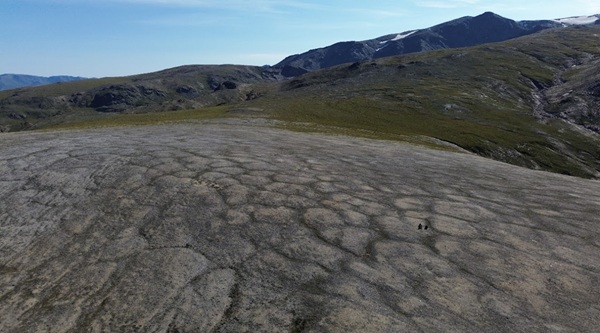
Polygonal ice wedge polygons in the Eastern Alaska Range near Delta Junction
Jamie T. Buscher
Hydrology Program Manager
Phone: 907-269-6557
Email: jamie.buscher@alaska.gov


