The geometry, scale, and evolution of hydrocarbon basins are a direct reflection of their tectonic history and the geologic structures which deform them. To more fully understand the formation of Alaska's oil and gas basins, we integrate inch-to-mile scale geologic mapping, detailed bedrock structural studies, bedrock thermochronologic cooling analyses, and interpretation of available subsurface seismic and well data to produce models for how the basin margins and proximal subsurface structures developed over time. The geologic mapping of local and regional structures, bedrock kinematic analysis of small-scale structures, and observations of cross-cutting relationships provide important information about structural geometries that control sediment accommodation in the basin and hydrocarbon containment. Thermochronologic analyses compliment the structural studies by producing ages during which the sampled bedrock cooled from depth, and can provide insights into the timing and magnitude of structural growth at the basin edge when considered a proxy for uplift and erosion. By integrating detailed stratigraphic observations collected simultaneously in the field by DGGS, these structural and cooling studies help paint a more complete picture of source-to-sink processes that control basin subsidence, deposition of reservoir and hydrocarbon source lithologies, and formation of structural and stratigraphic hydrocarbon traps.

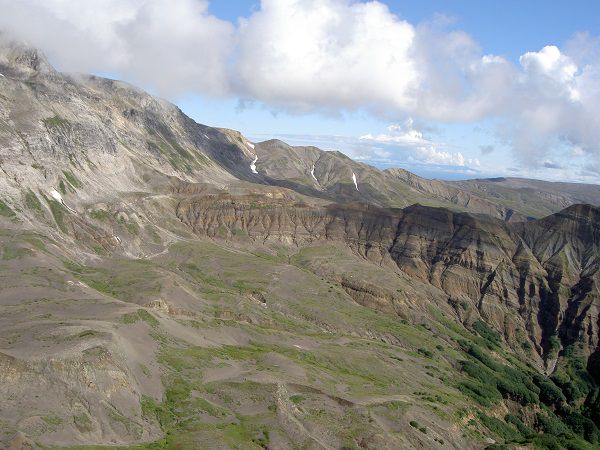
View toward the north showing the nonmarine West Foreland Formation (Eocene) in the right half of the photo in fault contact with Paleocene granite between Straight Creek and Capps Glacier. Photo credit: Trystan M. Herriott, DGGS.