Time-lapse cameras were installed in 2016 to monitor the shoreline fronting the community of Dillingham, including a peat meadow central to town, as well as the wastewater (sewage) lagoon. A water level sensor was also installed in 2016 at the city's T-dock. Funding to install equipment was provided by Alaska Sea Grant (ASG) and the Alaska Ocean Observing System (AOOS). Equipment installation was a collaboration between DGGS, University of Alaska Fairbanks Arctic Coastal Geoscience Lab (UAF-ACGL), Bristol Bay Native Association, and Alaska Sea Grant.
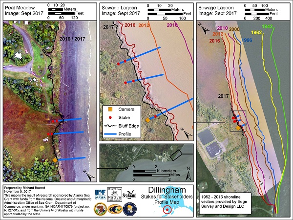
Click for enlarged PDF version of the profile map.
Since 2016, annual surveys have been carried out at each monitoring site. An updated erosion monitoring site map is shown above. The initial work in Dillingham laid the groundwork for current and future research in the region and is providing data to decision-makers as the City addresses the identified erosion risks to the town's sewage lagoon. This was discussed in a news article. Grant funding (2020) provided through Alaska Sea Grant, the Bureau of Indian Affairs, and the National Science Foundation will greatly expand the research and community engagement in Dillingham.
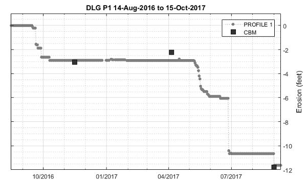
Graph of time-lapse and monitoring data between 2016 and 2017 at the sewage lagoon site. The gray data points were derived from the time-lapse measurements while the black squares represent on-the-ground community measurements. The close alignment between the two measurements attest to their accuracy. Notice the approximately 5 feet of erosion that occurred as a result of a single storm event just prior to July 2017.
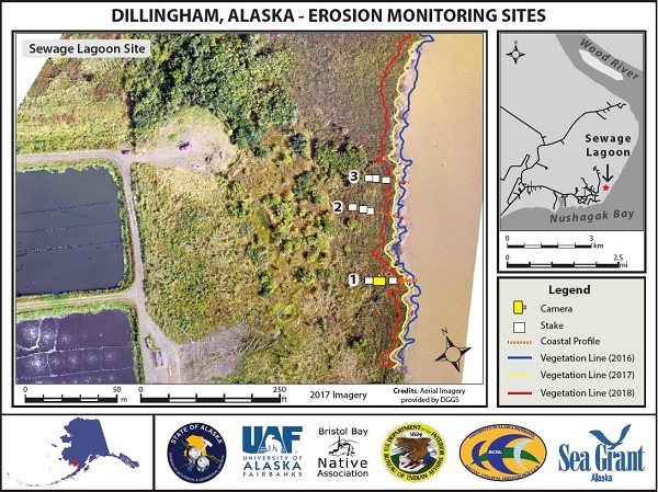
Updated map showing the erosion monitoring site located at the sewage lagoon. The site includes community measured staked transects and a time-lapse camera. The site is also surveyed by researchers every 1-2 years. During the past three years of measurements erosion rates have been as high as 10 m/yr (about 33 ft/yr).


