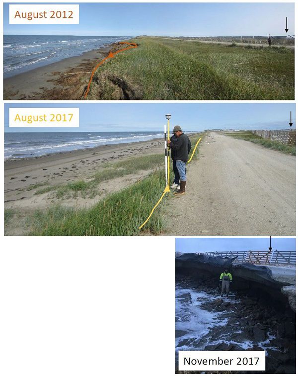
A time-lapse camera and tide staff were installed in 2017 at Shishmaref to monitor both shoreline change and flooding. Installation was funded by Alaska Institute for Justice and Alaska Ocean Observing System.
In November of 2017, Shishmaref was impacted by a coastal storm and photos of erosion were sent from the Native Village of Shishmaref to DGGS (see below).
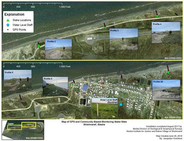
Click for enlarged PDF version of the profile map.