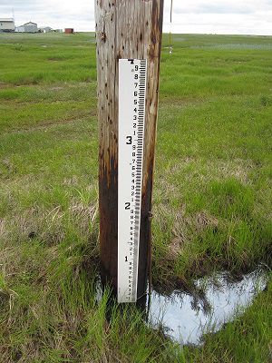
A time-lapse camera and tide staff were installed in 2017 at Kwigillingok to monitor both shoreline change and flooding. Installation was funded by Alaska Institute for Justice and Alaska Ocean Observing System, continued monitoring is being completed by the Native Village of Kwigillingok. In 2018, erosion monitoring stakes were removed and placed at new locations, which have been monitored since by the Native Village of Kwigillingok.
Click for enlarged PDF version of the profile map.
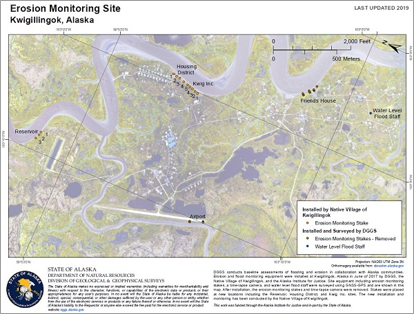
Housing Unit Site

Kwig Inc. Site

Reservoir Site
In 2021, a water level sensor was installed on a bridge at Kwigillingok. Real-time water level measurements are available at the Alaska Water Level Watch Data Portal.. The water level station was funded by the Alaska Ocean Observing System and is maintained by DGGS.
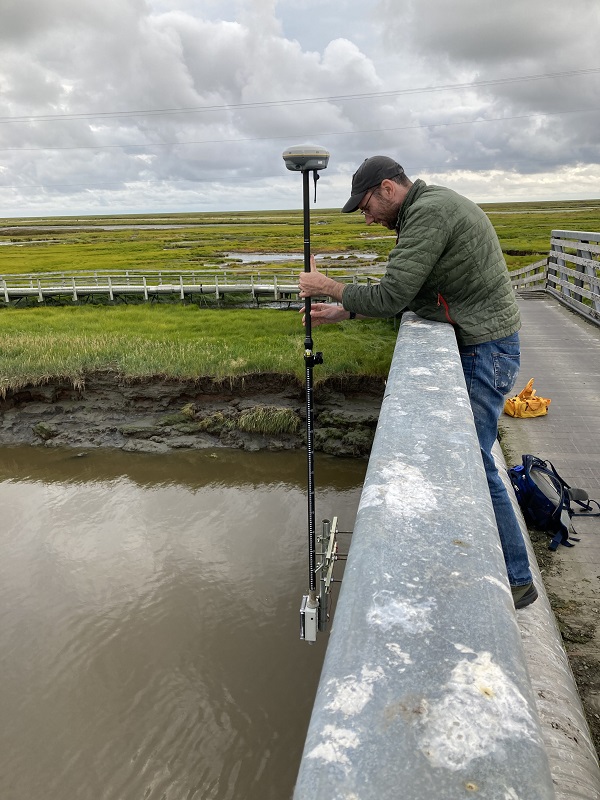
DGGS staff Andrew Herbst surveys the height of the Kwigillingok water level sensor after installation (August 2021).


