A time-lapse camera and tide staff were installed in 2017 at Kotlik to monitor both shoreline change and flooding. Installation was funded by Alaska Institute for Justice and Alaska Ocean Observing System, continued monitoring is being completed by the Native Village of Bill Moore's Slough.
Water levels have been reported on the Alaska Water Level Watch Facebook page. Shoreline monitoring has been conducted using a tape measure from stakes installed and surveyed by DGGS. These measurements have been taken at three locations along the river bank, including sites named: ANTHC Yard, Chris's Site, and AC Hardware.
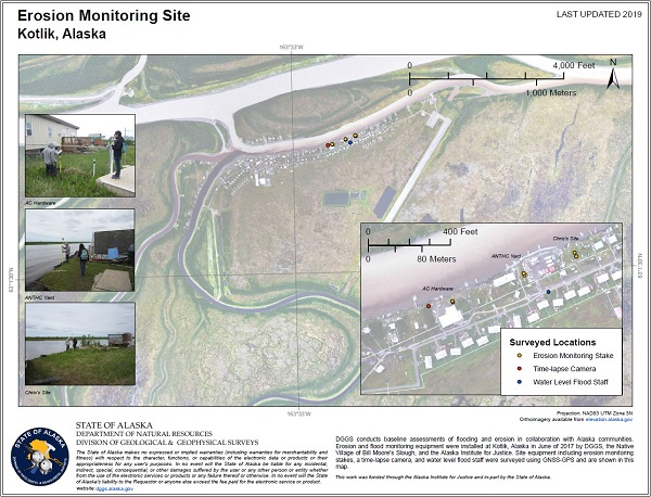
Click for enlarged PDF version of the erosion monitoring site map.
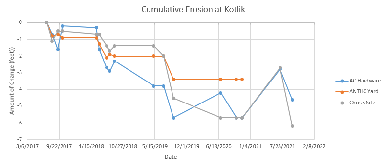
This plot is based on community measurements of distances from stakes to the riverbank show between 3 and 6 feet of erosion at these sites since 2017. The ups and downs of the data are due to the measurement procedure and expected levels of error in this measurement method.


