Time-lapse cameras were installed in 2016 to monitor the shorelines fronting Meshik, the old village site for Port Heiden. Funding to install equipment was provided by Alaska Sea Grant and Alaska Ocean Observing System. The install was a collaboration between DGGS, University of Alaska Fairbanks, Bristol Bay Native Association, and Alaska Sea Grant.
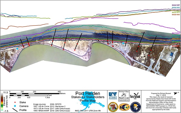
Click for enlarged PDF version of the profile map.
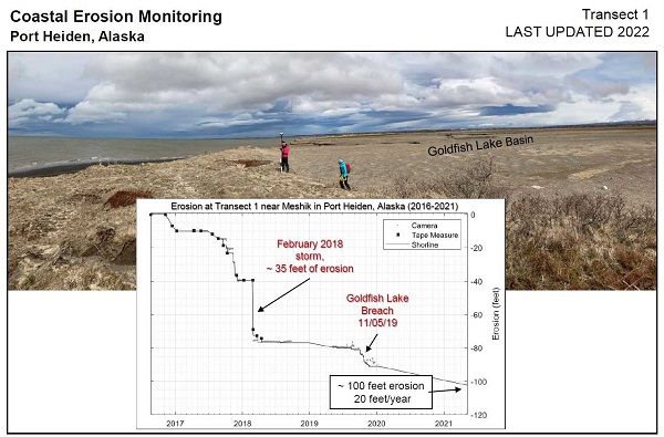
Shoreline change measurements showing erosion after storm events and the breach of Goldfish Lake at Port Heiden. Click for enlarged PDF version of the erosion plot.
Erosion rates took an uncharacteristic pause after the February 2018 storm, but the eroding bluff eventually met the edge of Goldfish Lake on November 2, 2019. The draining began with a small trickle and quickly opened into a wide waterfall. Water poured out over the next week, lowering the lake level as the water body shrank. The draining has slowed, and part of the lake still remains. For the community perspective and more information, see LEO network (must be a LEO network member to access).
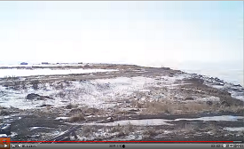
Time-lapse camera video used to compute shoreline change measurements at Port Heiden, Old Tank Farm.


