A baseline topographic survey and establishment of two erosion monitoring sites was carried out in 2018. The monitoring sites were placed in areas of community concern, given risks posed by erosion to a main road and an important bulkhead facility critical to the commercial fishing industry. Funding for this work was provided by the Native Village of Pilot Point. The ongoing research is a collaboration between the Native Village of Pilot Point, DGGS, and the University of Alaska Fairbanks Arctic Coastal Geoscience Lab (UAF-ACGL).
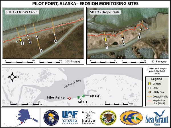
Map of erosion monitoring sites at Pilot Point, Alaska. Site 1 is positioned next to an old cabin that had been damaged by storm surge and a main road leading to the Dago Creek bulkhead. The site consists of a time-lapse camera and four community measured transects. Site 2 is located at Dago Creek where local observations have reported erosion and significant damage to the bulkhead.


