A baseline topographic survey and installation of two erosion monitoring sites was carried out in 2018. Two time-lapse cameras were installed to monitor the shorelines fronting Nelson Lagoon. Cross-shore profiles were also established for monitoring beach volume along the ocean side beaches. Funding for this work was provided by the Alaska Institute for Justice and the University of Alaska Fairbanks Arctic Coastal Geoscience Lab (UAF-ACGL). Funding (2020) provided by Alaska Sea Grant will further expand the research and community engagement in Nelson Lagoon.
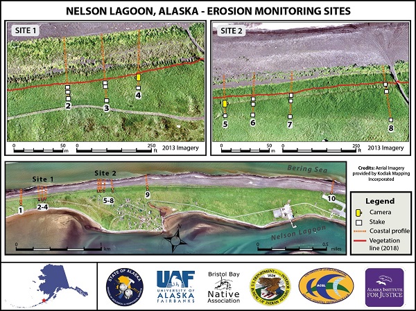
Map of erosion monitoring sites at Nelson Lagoon, Alaska. The sites are located on top of a beach ridge fronting the ocean side coastline. Each site consists of a time-lapse camera with 3-4 staked transects where local environmental coordinators take repeat measurements. Important infrastructure that may be at risk from erosion includes the village dump site (Profiles 1 - 4) to the west and the airport (Profile 10) to the east.
In 2019, a water level sensor was installed at the Nelson Lagoon Dock by the University of Alaska Fairbanks Arctic Coastal Geoscience Lab. The sensor lost power over the winter of 2020, but was re-installed in 2021. Data are available at the Alaska Water Level Watch Data Portal. The water level sensor is funded by the Alaska Ocean Observing System.


